Walking Bremgarten - December
With our Christmas break started, and keen pre-emptively to walk off some of the seasonal excesses, Jules and I headed to Bremgarten to do a variation on walk #49 from the Rother book; Rund um den Zurichsee.
We did do this walk a few years ago, as part of a trip away to Bremgarten, but it had been a while and we fancied doing it again. We also hoped that the shops would be open in town, as we expected all the restaurants to be closed owing to the more stringent Covid-19 measures. We parked in the centre of town and set off along the river to start the route. We saw some brave kayakers on the Reuss out for a paddle, in what looked like lovely conditions (assuming one stayed out of the water). Leaving the river the route climbs fairly steadily up through Bellikon (the roundabout is no more beautiful than before) and then on up the Heitersberg. Once again we declined the loop around the Aegelsee and instead had lunch in the lee of the hill overlooking the Uetliberg.
The weather turned a little as we finished eating, and so we made pretty steady progress looping back to Bremgarten. The Alps were surprisingly clear and visible for a grey and cloudy day, and there were some rather pretty and unusual views of the red sunset catching the snow.
Overall it was 16.8km with 480m of ascent/descent which took us 3 hours 20, not including the stops and breaks. The gpx plot of our route is here, and it's a T1 with fairly easy navigation.
Walking Meilen to Stadelhofen - December
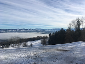
Keen to get out of the Zurich fog, and get a stretch of the legs I headed down to Meilen to do the walk back to town via the Pfaennensteil
I took a slightly different route up the hill this time - it's the same ascent, but following the stream up through the trees, rather than on roads, which was a nice change. I climbed up out of the fog, into the clear sunshine and was rewarded with some rather spectacular views of the alps - it was a glorious day above 600m.
The snow line started shortly above the fog, and by the time I reached Hochwacht there was a decent covering. It was pretty quiet, so I took the opportunity to go up the lookout tower to see the full views of the alps - definitely a Saentis - Pilatus day and probably even further.
After a stop for a bite of lunch, I headed on down to Forch, past the loipe which had one brave soul doing cross-country and on to Forch. From there I took the usual route down to Stadelhofen to finish off a nice walk.
Overall it was 22km, and took me about 4hrs 15, not including breaks and lunch, or the trip up the lookout tower.
Walking Meilen to Forch - November

Not wanting to go too far, but keen to get up out of the Zurich fog, Jules and I headed down to Meilen to walk up to Hochwacht and then on to Forch.
This is a route that we've done a few times before so the navigation was very easy. The route climbs steadily out of Meilen (it's a good warmer-upperer!) up to the restaurant at Hochwacht. We were treated to views to the Rigi and Pilatus on the way up, which was a lovely sight after the fog down at Zurisee level. It was a bit crowded at the restaurant so we didn't go in, but we did admire the views south to the alps and across to Saentis.
The descent down to Forch was easy, although the views over the Greifensee were a little hazy. We arrived at the station in Forch in daylight, but with the sun starting to set. A good walk and a stretch of the legs without any stress and not too much travel.
Overall it was 9.7km with 480m of ascent and 230m descent. It's a T1, and took us about 2 hours including the time to admire the views. The gpx plot of our route is here.
Walking Etzel - November

With a lovely day forecast, and the promise of clear views above the fog, Jules & I headed to Pfaeffikon to walk up the Etzel.
We parked in the centre of Pfaeffikon (still avoiding public transport where possible), and started on the usual route up the hill. We did briefly consider doing the walk in reverse, but decided that the very steep section in the woods near Etzel Klum was better going up than down, so we did it the same way round as previously. It's a fairly steady climb, but we paced it a little better on the lower slopes this time, so weren't as out-of-breath at the top as previously.
We were treated to spectacular views on the way up of Speer, Saentis, and the Churfusten, and then really stunning views over the Sihlsee, Grosser Mythen, and the Alps proper from Etzel Klum. It was definitely a Saentis to Pilatus day.
We stopped for a bratwurst in the restaurant to show a little support, but we didn't stay very long as there was a steady breeze over the ridge, and it certainly felt as cold as the stated 5-6C. We were treated to lovely views of the Zurichsee on the descent. Once again this route didn't disappoint, it's a lovely route with a decent climb, and not a long journey from Zurich.
Overall it was 10km with 675m of ascent/descent and took us 2hrs 35 not including the stops. It's a T2, and the gpx plot of our route is here.
Walking Atzmännig - November
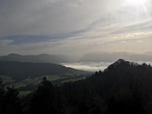
With the weather forecast better above the fog, we headed to Atzmaennig in the hope that Jules could finally see the spectacular views of the alps.
We arrived after a slight navigational error (we also managed to confuse Imke), but eventually we all made it to find the car-park at the adventure park considerably more full than we'd expected. The last time I was there, there were only two other cars in the car-park. However there was no problem parking, so we made ready and headed up the hill.
We took the usual route, which climbs pretty steadily up from the lift station to the Harz Bergrestaurant. We arrived in time for drink and a snack before the main lunch crowds (although with the number of people on the mountain, the restaurant didn't look like it needed our support very much!) and enjoyed the view for a little while. From there we continued on up the ridge, with quite good views of Säntis and down the Glarus valley.
We stopped for our picnic lunch on the ridge, and then again a little later for tea and cake on a very nice bench with excellent views down to the Zurisee, with the mountains in the background.
The weather was fairly kind to us - not quite the crystal clear views that we'd been hoping for, but a lot better than our previous visits and lovely in the sunshine.
Overall it was 9.1km, with about 630m ascent/descent and took us 2 hrs 50 not including the stops. It's a T1 and the gpx plot of our route is here.
Walking Sihltal - November
We had been planning a trip to Atzmännig all week to see the lovely views of the Alps. Unfortunately when we woke up on Sunday the forecast good weather had not materialised, and we had to come up with another plan. Looking for something a bit closer and lower down, Jules discovered another walk in our favourite book - Rother Rund Um den Zurichsee. Once again the book didn't disappoint - this was a lovely shorter walk, and perfect for the weather.
We elected to drive to the Sihltal rather than take the train - for the standard Corona related reasons. We parked at Sihlwald and headed up the hill, following route #46 from the book. The path climbs steadily through mixed wood forest (the largest unmanaged mixed wood in Switzerland, apparently), and then follows the contours about half way up the Albis ridge. The route then drops down into the Sihl valley at Sihlbrugg station before crossing over the river and climbing the other side. We took a slight detour up to see the views from the Zimmerberg before continuing on back round to Sihlwald.
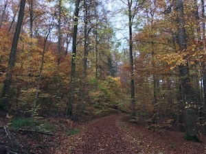
The trees were in lovely colour - the beeches yellow through rust and contrasted nicely by the evergreens. The weather wasn't quite as bad as forecast, we managed to take off our raincoats about half way round, and it was warm enough to sit and have a cup of tea and a biscuit near the top of the Zimmerberg
Overall it was 13.2km, with 460m ascent/descent and took us 2hrs40 + breaks. It's a T1, and the gpx plot of our route is here.
Walking Rotkreuz - October

After a spell of pretty uninspiring weather, but with a break in the rain forecast and the promise of clear skies above the fog, Diana, Luis, Jules and I headed down to Rotkreuz to try a walk from www.bergwelten.com - Rotkreuz circular.
The route was purported to have lovely views and certainly didn't disappoint. The weather was kind to us, and we were fortunate to catch the leaves changing - in particular the beech trees were in lovely colour. The visibility was good to the Rigi, and also the Grosser Mythen and the alps proper in the distance.
The route heads out of Rotkreuz, climbing gently past Chappelerberg and then climbs the ridge to towards Michaelskreuz. We stopped to see the Kappel and admire the views, and then headed on up to the peak at Rooterberg where we had our packed lunch in the sun. After lunch we headed down to the restaurant at Michaelskreuz for a coffee and a cake (trying to show a bit of support for the local businesses), before heading on back down to town.
Overall it was 11.45km, with 440m of ascent/descent and we'd rate it an easy T1. The gpx plot of our route is here.
Walking Euthal - September

With lovely late summer's day forecast, Jules and I headed off to try walk #30 from the favourite Rother book - Rund um den Zurichsee - a bit surprised that there are any new ones still in there!
We arrived at Euthal after an easy drive and parked slightly out of town near the lake. It was a beautiful sunny day - no clouds in the sky, and about 29C - perfect walking conditions. The route starts off flat in a quiet valley, then climbs steadily through the trees up towards the Wildegg hut, breaking out into the sunshine more and more until clear of the shade. We saw more and more people as we climbed, including some very young children - doing well on little legs. As usual there were also some fit, elderly Swiss - I hope I'm still climbing mountains in my nineties!
We declined to stop at the Wildegg hut as it was completely full and instead headed on up the Chil-Aubrig. We made the summit, but didn't hang about as there were swarms of flying ants (or something) right up at the peak, so we beat a strategic retreat back down the hill. We stopped for a picnic lunch on the grass next to the Wildegg hut, then continued on the loop.
The route follows the ridge line, with good views back off the peak. It turns out that the other side of the summit is very sheer - which goes to show what you don't know doesn't hurt you! The route undulates with one more climb before dropping down to the Sihlsee just outside Euthal. From there it was just a short flat leg along the waterfront back to the car.
Overall it was 19.2km with 660m ascent/descent and took us 3 hrs 45 of walking time. We'd rate it as a T2, and the gpx plot of our route is here.
Walking Stäfa to Rapperswil - September
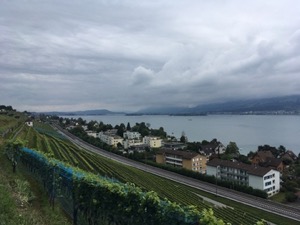
With pretty uninspiring weather settling in for the day, Jules and I decided to stay low and not travel too far for a little walk. We decided to go back and do route #19 from the Rother book Rund um den Zurichsee - Stäfa to Rapperswil.
It was definitely a good choice for the weather - low grey cloud and a few spots of rain later on in the day, but it was nice to get out and stretch the legs, particularly after my cycle ride the previous day. However, we did get to see most of the views on the walk, and it's still a really nice trip alongside the Zurichsee.
We made fairly steady time to Rapperswil and enjoyed a coffee in the main square before taking the train back to town. All in all a nice little walk, with very little travel or planning required.
Overall it was about 11.4km, with 200m ascent/descent, T1 and took us 2 hours 10 minutes. The gpx plot of our route is here.
Walking Aegerisee - July
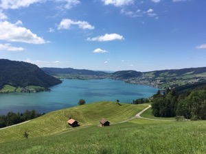
Feeling up for a long walk, with an excellent day forecast and a lot of daylight for us, Jules and I headed to Unteraegeri to do route #40 from the favourite book Rund um den Zurichsee. The route follows (broadly) the route of the Aegeri Panorama Weg around the entire Aegerisee.
There were a few clouds in the sky when we arrived, but we were slightly grateful for the shade as the route climbs fairly steeply up from Unteraegeri, them more gently around the rolling hills to the north-east of the lake. There were lovely views of the see for most of the day, and the few clouds evaporated in the summer sun, leaving us with a beautiful day to enjoy the countryside.
We followed the route clockwise around the lake, first around to Ratten where we had some good knusperli for lunch, then dropped down to Morgarten where we stopped for a well deserved ice cream. From there the route follows the lakeshore for a short way, before the final ascent to Sod and from there it's a fairly rapid descent back to lake level for the final stretch into Unteraegeri.
It's a very pleasant walk, but not for the faint-hearted given the overall length and the height gained/lost. It was 27km with 1070m ascent/descent, and took us 5 hrs 45 (plus the stops for lunch and breaks). The gpx plot of our route is here.
Walking Albishorn - June
With reasonable weather forecast, and likely the last Monday walk for a while, Michael and I headed off for a variation on route #7 from green book Rund um Zürich.
The route starts with a steady climbs out of Sihlwald. After correcting a slight navigational error [cough] we headed on up to and along the Albis ridge. The weather was warm and a bit sticky and we were glad to get into the gentle breeze at the top.
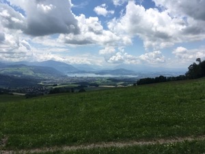
We stopped for a möst and Lemon meringue pie in the restaurant Albishorn, and then stopped for a very pleasant packed lunch (complete with a cold glass of wine, compliments of Michael) just before the descent from the Albis ridge. We were treated to views out across Zug and the Zuggersee whilst we ate, with the Rigi and the base of Pilatus just visible in the background, sometimes obscured by clouds.
Heading off, we dropped down to the Sihlwald valley and the back along the river. Arriving at Sihlwald, we decided to continue on to Langnau, as the time to wait for the next train was about the same as the time to walk to the next station. We caught the train back into town and headed to Rio to finish off with an Aperol for old-times sake.
Overall it was a very good day's walk, with good value from the very short journey out of the centre of town. The slight variation on the route in the book ended up being 19.5km with 650m ascent/descent, and took us 4hrs. It's rated a T2 in the book (and who am I to argue), presumably for the final climb up to the Albis ridge, and the route along to the Albishorn restaurant. The gpx plot of our route is here.
Walking Reuss (Mellingen to Bremgarten) - June

With a lovely day forecast and wanting a walk not to stressful or hard, we headed to Mellingen to meet up with Diana & Luis to follow the route #42 along the Reuss to Bremgarten.
The navigation was pretty easy. We made our way from the station to Mellingen centre and from there we followed the right hand bank of the river as it winds its way through the Aargau countryside, under blue skies. Despite being a little early in the year, the river was being well used, with people picnic-ing in the fire-stations, and some paddlers on the water.
We stopped for a drink at the campsite at Sulz. We then stopped again a little further along for a picnic lunch at about 3km from Bremgarten. We were treated to some beer provided by Luis, and cake from Jules and Diana.
We continued around the Bremgarten loop to see the kanuland river entry point, and spent a little time watching the surfers at Bremgarten.
We finished up with a beer in the pretty old-town to round off a very nice and relaxing walk. Overall it was 17.3km, with 160m ascent, 190 m descent and it's an easy T1. It took us 3hrs 25 minutes not including the stops or breaks, and the gpx plot of our route is here.
Walking Menzingen - June

With the weather forecast a bit marginal, and some time constraints, Michael and I headed to Menzingen to try route #36 from Rund um den Zurichsee.
After a brief parking faff we headed off on the route. We went the opposite way round from the previous time - not for any particular reason, just a bit of mis-navigation at the start. However, this proved to be a nice variation, and I think the route works well either way round.
I managed to remember the bridge that is still doesn't exist, and the path it doesn't meet, and wasn't caught out this time. Unfortunately the cafe at Höllgrotten was closed on the day, but we had a packed lunch in the shade of a farm building overlooking the Zuggersee.
The weather was a bit hot and humid, and clouds threatened to rain for the second half of the walk, but it stayed dry for us all the way. The clouds did clear slightly for us as we arrived at Gübel and we managed to catch a glimpse of the Rigi.
Overall it was 12.2km this time (didn't spend so long trying to find the bridge and path) with 450m ascent/descent and took us 2 hours 30 minutes, not including the break for lunch. The gpx plot of our route is here.
Walking Meilen to Stadelhofen - June
With the weather forecast a bit marginal, and low clouds around, Michael and I headed to Meilen to walk up the Pfaennensteil to Forch, and then possibly on a bit further.
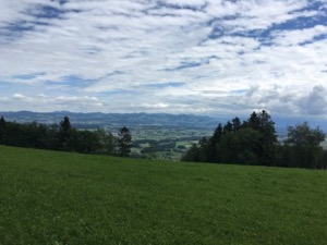
It was better weather than we had feared, with sunny spells and dry for the whole walk. We set off at a bit of a pace up the hill, and arrived at the Pfaennensteil about lunchtime. We declined the restaurant (the outside area was closed), and instead had our packed lunches in a sheltered spot up on the hill.
After lunch we headed on down to Forch, and from there decided to carry on towards town, taking the route which climbs past the war memorial and through the woods and golf course before dropping down into town. We made it all the way to Stadelhofen, and decided to recuperate with a beverage in Bellevue.
Overall it was a shade over 20km, with 550m of ascent/descent and an easy T1. The gpx plot of our route is here.
Walking Triemli to Langnau - May
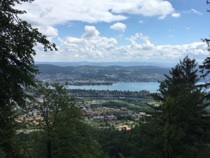
Trying to squeeze in a walk around work commitments (work can really get in the way of a day out), Michael and I headed to Triemli to do a walk along the Uetliberg ridge.
We made good progress on the ascent, and were soon at the top enjoying the views out over the Zurisee. After a brief respite at Ulto Klum, we headed off along the ridge towards Felsenegg. We did a couple of minor variations on the normal route, but basically it's the same - through the trees, following the ridge-line, enjoying the views.
The weather was good, with views to the Rigi, Pilatus and beyond. The paragliders were having a good day too - there was a bit of a queue to use the take-off spot, and there were quite a few in the air as well.
We made Felsenegg in good time, and decided to walk on down to Langnau, a decision that was assisted by the Felsenegg gondola being closed, presumably for Corona. We therefore continued along the ridge a little way (I don't think I've actually walked this section before), before dropping down into Langnau. The route down is pretty easy, a little steep on the path in places but well made and trivial to follow. We arrived in Langnau in glorious sunshine, and there was just time to grab a beer before taking the train back to town.
Overall it was 15.5km, with about 650m ascent/descent and it took us a bit over 3 hours (not including the break for lunch). The gpx plot of our route is here.
Walking Sursee - May
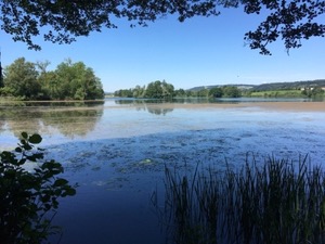
With great weather forecast for Ascension, we thought about trying to go Bräteln but reckoned that it might be a bit difficult to find a spot. Instead we headed out with a picnic and headed to Sursee with Diana, Luis, and Michael to try a walk from the yellow book Wanderrungen in der Schweiz - Mauesee.
The weather was beautiful on arrival, and after meeting at the station, we headed off on the walk. The route heads out of town quickly and loops around the pretty Mausee before ascending the hill. We stopped for our picnic lunch in the shade of an oak tree near the top of the hill, with lovely views out across the land.
The picnic turned out to be a great success (despite the slightly short notice to get everything prepared), we shared Coronation chicken salad, a tomato pasta salad (which was quite quick and easy to make), and a delicious potato salad from Diana. All washed down with a coffee and a grappa compliments of Diana and Luis.
After lunch, Michael headed back down whilst the rest of us completed the route. The path meandered through fields and woodlands, looping back to Sursee, with quite spectacular views of the mountains and lakes to the south.
Overall the walk was 15.8km and T1 with 420m ascent/descent and took us 3 hrs 10 not including breaks and lunch. The gpx plot of our route is here.
We finished with a beer (hurrah!) in the pub (more hurrah!) together (even more hurrah!) for the first time in a long time - an interesting local beer, with a good flavour and body. A great end to a lovely day.
Walking Sihlbrugg - May

With a glorious day forecast, Michael and I headed to Sihlbrugg to try route #45 from Rund um den Zürichsee by Rother - Hirzel to Sihlsprung.
The route started out with a bit of a climb from Sihlbrugg station. There was the reward of lovely views from the top - around the bend in the Zurisee and all the way to Speer and the Glarus group. Then around the corner we were treated to views of the Rigi and onto Pilatus.
We stopped for a coffee at Restaurant Spreuermühle just after Hirzel to give them a bit of support. It seemed like a nice little restaurant, and worth going back to at some point. We then dropped down through Hirzel village and down into the woods at Sihlsprung and to the river. There were lovely secluded spots on the river bank - I suspect they'd be full on a Sunday!
After a picnic lunch on the bank of the river, we then followed the Sihl back to Sihlbrugg. From there it was one last climb (where in the world did that come from?) following the path of the river back to Sihlbrugg station.
Overall it was 17.6km with 440m ascent/descent on well made paths and pavements. It took us 3 hrs 50 minutes, not including the stops for lunch and breaks, and the gpx plot of our route is here.
Walking Hallwilersee - May
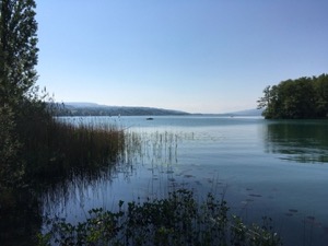
Looking for a walk in a mutually convenient location, and without too much climbing, Diana, Luis, Jules, and I headed to the Hallwilsersee to do a lap of the lake.
We started at the picturesque castle, standing inside its pretty moat and very old - dating from the 12th century in parts. From there we headed off clockwise around the lake, following the easy path. The lake is very pretty, and people were making the best of the good weather, paddling and sailing. We did notice that no-one was actually swimming - probably a little early in the year for that just yet.
The navigation for the route was trivial, with only slight challenges were the path is diverted around badis (presumably only in summer), and we made good progress. We stopped for a cold drink at the campsite at the southernmost point of the lake, and then had our picnic lunch a little further on.
After lunch we continued on around the lake, stopping for a slice of cake (complements of yours truly) and a coffee (compliments of Diana & Luis). We arrived back at the castle in mid-afternoon, having completed the 22km in 4 hrs 15 walking time. The walk is a good stretch of the legs, and a nice warm-up for longer summer routes, but I doubt that we'll rush back to do it again as it's a little flat and boring. Would happily got back to the lake though...
The gpx plot of our route is here.
Walking Baarberg - May
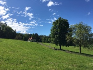
With the Corona lockdown starting to ease slightly, and keen to get out, Michael and I headed to Baar to try walk #39 from the favourite book - Rund um den Zürichsee by Rother.
The weather was glorious when we arrived, and we set off up the hill. We realised pretty quickly that there would have been a more convenient place to park, but on the other hand, parking near the brewery did allow me to pick up a "Handtasche für Manner" (lit. handbag for men) to try sometime.
The route heads up into the trees, climbing steadily but gently on easy to follow gravel tracks. The route loops around the top of the hill before looping again around the base of the hill to return to the start. There weren't quite as many views as one might hope, owing to being fairly wooded, and the paths being set back a little from the edge of the tree-line.
We stopped for a packed lunch sitting in the sun at about the half way point, and then continued on back to where we'd started. We reckoned that this would be a great walk for the height of summer, because the trees provide a bit of shade, there are fire pits for barbecuing, and the brewery shop also sells cold beers....
Overall the 9.8km with 360m ascent/descent took us slightly over 2 hours, and it's a T1. The gpx plot of our route is here.
Walking Bremgarten - May
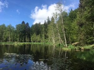
With a fairly good day forecast, and all of us very keen to get out of our respective houses, Diana, Imke, Luis, Jules and I headed to Bremgarten to try the Five Ponds walk from www.bergfex.com.
The route starts a little way outside Bremgarten. We parked in the station carpark at Bremgarten-West, and then headed away from town up into the hills on the outskirts of town. From there the route meanders through the woodland, on a little tour of the ponds, starting with the largest - Rotwasser and then Cholmoos. The woods are adorned with sculptures in places, which range from amusing to darker and more sinister - often they seemed to be fables or parables with cautionary tales. From there we looped around the Tierpark before heading north to cross Bremgarterstrasse (not a very nice road to cross) to take in the Fischbacher Moos before looping back to Bremgarten.
We stopped for a picnic lunch, once again enjoying a coffee courtesy of Diana and Luis and a banana and rum cake courtesy of yours truly. Luis and I chucked around a frisbee (hadn't quite forgotten how to do that), and we finished with a small glass of rum, courtesy of Luis.
All in all it was a very pleasant stroll around the woods, in good company and nice to get out. Overall it was 13km, T1 with 200m height gained/lost and it took us about 2 hrs 35 minutes, not including the stops for lunch and sightseeing. The gpx plot of our route is here.
Walking Eglisau - April
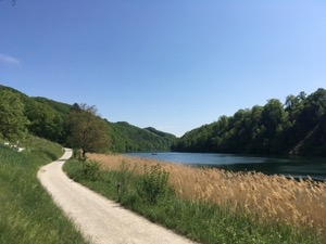
Keen to get out, but not wanting to drive to far, Jules and I headed to Eglisau to try a walk from Rother Rund um den Zurisee #7 around Eglisau, hoping to avoid the crowds.
We have been to Eglisau before - cycling in 2015, but we hadn't seen the town centre. This turned out to be a very pretty old town, complete with a picturesque church and timber framed buildings in the traditional Swiss style. After wandering through town (and taking a look at where I had landed paddling in 2019) we headed off up into the vineyards above the north bank of the Rhein.
The route climbs steadily and then steeply up onto the ridge, and then loops round to Buchberg. We continued on to the Church to see the views out over the Rhein valley, and could just about convince ourselves that we could see where the Thur joins the Rhein. Satisfied with the view we headed back into the village and then on out to the elbow in the river, via the Lindenhof hoflanden where we picked up a bottle of the local wine. The route then follows the course of the Rhein, dropping down steeply at one point before meandering back into Eglisau.
The weather was very kind to us for the whole walk - the forecast cloud and drizzle not materialising. This made it a very pleasant day, although we would probably avoid this walk in the height of summer, as the middle section on top of the hill has very little shade.
Overall it was 14.1km with 300m a/d and took us 2 hrs 55. We'd rate it a T1+ and the gpx plot of our route is here.
Walking Zofingen - April
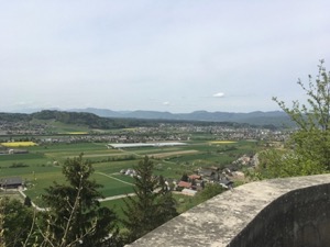
Keen to get out of lockdown, and with a nice day forecast, Jules and I headed over to Zofingen to try a walk from a new book from Rother WanderFuehrer Aargau - Rund um Zofingen.
We met up with Diana and Luis in Zofingen and after socially distanced greetings headed off. The walk starts out through the very pretty old town, then climbed gently through woods to see the local caves. From there the route continues on up to the ridge of hills which it then follows for the next section. We stopped for lunch at the schloss above Wikon, which turned out to be a bit of a mis-mash of architectural styles from near brutalism to medieval with a few anonymous office block sections thrown in. We weren't very surprised that the photo in the book was from the schloss looking out, rather than of the schloss itself. We decided to do the same. Lunch was accompanied by a very good coffee (compliments of Diana and Luis) and a rather good cherry cake (compliments of Jules).
After lunch we continued on back to Zofingen, stopping briefly at the animal park to admire the turkeys, chickens, large deer and a very impressive boar. From there it was just a short walk down the hill to finish a very pleasant walk, and a good start to the new book. The only thing missing was a post-walk beverage, but alas, Corona and all that.
Overall the walk was 13.4km with 480m ascent/descent and took us 2 hrs 50, not including the stop for lunch. The gpx plot of our route is here.
Walking Ricken - April
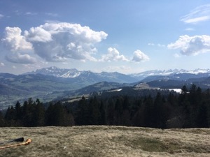
With the weather turning out much better than expected, Jules and I headed to Ricken to get a stretch of the legs and hoping to avoid the crowds.
The chosen route was Ricken - Regelstein Rundwanderung from www.h-und.ch which is a circular walk starting just outside the village of Ricken in St. Gallen and heading up to the top of the Regelstein.
We had no trouble parking, and set off up the hill in glorious weather. The walk starts by climbing gently but then steepens and continues up through pretty woods all the way to the top of Regelstein, with occasional glimpses of the promised views.
We weren't the only ones enjoying a rest and the lovely views at the top, but it wasn't at all crowded and there were no problems with social distancing. Unfortunately we didn't get to hear the Alpine horns that one group had carried up there, and it felt a bit much to ask them to play a tune just for us!
We ate our packed lunch, admiring the views of Saentis, the Churfirsten, and Speer before heading down via Alpwirtschaft Rittamrren and down to the valley to complete the loop. There were good views of the Zürisee on the way down, as well as the Glarus valley to our left.
Overall it was a very good walk, the 9.25km with 500m ascent / descent took us 2hrs 15 plus the stop for lunch. It's a T1+ owing to the steeper sections on the ascent, and the gpx plot of our route is here.
Walking Aadorf - April
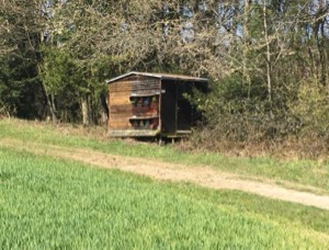
Keen to get out of the flat, but wanting to stay away from the crowds (for all the obvious Corona-related reasons), Jules and I headed off to Aadorf to try route #34 from the COOP book of walks.
It was a bright sunny day as forecast, and it was just starting to warm up when we arrived. After a short way through town, the route starts to climb into the hills surrounding Aadorf. The route has some nice variation - pretty woodlands, small villages, streams, and farms and vineyards which was very pleasant. There were definitely fewer people out than one might normally expect, and those people we did see were practicing social distancing quite responsibly.
We stopped for our packed lunch at the edge of some woods, and sat down on some felled pine trees. There was some excitement when yours truly got a little too close to some beehives and was chased off down the road ("attacked by bees!"). Fortunately I didn't get stung - I think they just didn't want me close to the hive that early in the season.
The walk continued on up to the Schloss at Sonnenberg which we'd seen in the distance, before looping back to Aadorf. Overall it was a very good walk and a decent long stretch of the legs. The 21.5km and 400m ascent / descent took us 4hrs 10, not including lunch and a couple of breaks, and it 's a T1. The gpx plot of our route is here.
Walking Heidiland - March
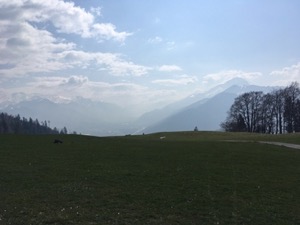
With a lovely day forecast and very keen to get out and stretch legs after being cooped up in the flat, Juliane and I headed to Heidiland to do a repeat of our walk from May 2016
The weather was slightly hazy on the drive down, but turned into a lovely spring day by the time we arrived in Maienfeld. We headed off up the hill, following a slightly different route through town than previously, but made good progress to the Heidi village. Unsurprisingly everything was closed owing to Covid-19, but we had the path (almost) to ourselves as we continued on upwards.
We made good progress to the Heidi hut (also closed), and sat on the grass outside to eat our packed lunch. The weather was really lovely for the time of year - bright and sunny and with slightly hazy views down the course of the Rhein towards Chur. Suitably refreshed we headed down the hill and back to Maienfeld via Jennis, again taking a slightly different route through the vineyards down in the valley.
Overall the 14.4km, with 700m of ascent & descent took us 3 hours, not included the stop for lunch. The gpx plot of our route is here.
Walking Hittnau - March
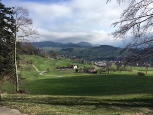
Keen to get out and stretch our legs after being confined at home for the week, but also wanted to stay away from any crowds, we headed off to Hittnau for a circular walk up the Rosinli courtesy of www.bergfex.com
It was a fairly bright and sunny day in March, but there was a cold wind and so we were wrapped up pretty warm. The route was fairly varied as it meandered up the hill through woods and next to streams, with occasional views out over the surrounding countryside. At the top of the hill there's a large, flat plateau area ending at the Rosinli lookout area.
We tried to support the local restaurant with a drink from their take-away area, and although we weren 't the only ones showing support, we suspected that they were doing a lot less business than they normally would.
From the lookout point the route descended back into Hittnau to finish a very pleasant stretch of the legs. Overall the 9.7km with 300m of ascent/descent took us 1 hour 55 minutes, not including the stop for a coffee. The gpx plot of our route is here.
Skiing Klosters - March
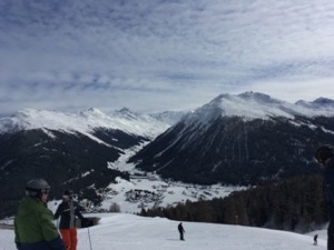
With a lovely day forecast and recent snow during the week, we headed down to Klosters so that Jules could use the Loipe and I could go skiing with Toby and the gang.
We had a fairly relaxed start from Zurich, and after eventually finding a parking space (we weren't the only ones with the idea of going up the mountain) I dropping Jules off and headed up the slopes. I caught up with the guys at Muggahutte for a late lunch, and then headed off for a cruise around
It was a fairly relaxed day, and we even headed down to Davos for a very pleasant drink in the sun at Hotel Seehof, before cruising back over to Klosters. The snow was in great condition, including some fun bits off to the side.
All in all a very pleasant day, in good company. We managed a fairly relaxed 23.3km and 3,600m vertical over 6 long runs
Skiing Flims - March

With a bit of a marginal day forecast, but keen to get out on the slopes, Michael and I headed to Flims to try to make the best of it.
The conditions weren't great - quite grey which meant that the visibility wasn't that good, and windy which meant that top of the mountain was closed, but we headed off anyway for a cruise around.
We decided to stop for an early-ish lunch after a very exfoliating run down to Stargels. We were sat on a shared table, and eventually joined by two other groups of two - one couple and one father/daughter, which ended up being a very fun conversation over good food.
After lunch the weather had brightened up a bit so we headed over to try out ski-route #81, which turned out to be excellent, some of the best snow we'd had in the resort all season, although it did get a little bit technical in places. We ended up having a better than expected day, although it was slightly marred by Michael falling on the way down stretch and cracking a rib, although not so badly that he couldn't ski down.
Overall we managed a perfect respectable 41.8km and 7,480m of descent over 13 runs
Skiing Klosters - February
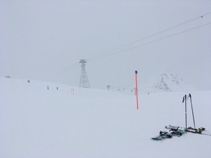
With a somewhat marginal day forecast, but keen to get out and do a bit of skiing, I took Toby up on his kind offer to join him skiing a day in Klosters.
After a fairly relaxed start, but an easy drive down I arrived in Klosters in the late morning. The weather was a bit grey on arrival, but we headed up anyway to try to make the most of it. We did a couple of runs to warm up, and it became apparently fairly quickly that Bex was the best skier amongst us by some margin. Anyway, it was great to have someone else leading, even if I did have to hustle a bit to keep up!
We found better conditions further up the mountain - in particular run #1 down from Weissfluhgipfel was in very good nick. We did fairly well to cover the mountain, albeit trying to stay a little higher. We had a go at the race route (Bex beat me quite convincingly), before stopping for a good late lunch in Speichersee Totalp. We finished with a relaxing run down to finish the day, slightly marred by the rain which started about half way down route #21 and was a steady drizzle by the time we arrived at the bottom.
Overall it was 28km over 8 runs, with 4,300m descent, in great company
Skiing Lenzerheide - January
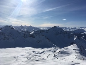
Taking a chance on the snow, Michael & I headed to Lenzerheide expecting to have a gentle cruise around and to check out the area.
We decided to park at Parpan to try out the "middle" section of the mountain. The weather was better than forecast - blue skies and great views over the surrounding mountains, and the snow was better than we had feared. Somewhat enthused after the first few runs, including a trip to the very top, we headed over to the Arosa side to try to make the most of the conditions.
We stopped for an early lunch at the Hörnli Hütte, but made the slight mistake of sitting outside - not the best plan in -5 with the wind blowing, even if it was sunny and sheltered. The fare was good - tasty spare ribs and rösti, but we didn't linger for fear of frostbite.
From the top, we headed down under the Hörnli lift where to our pleasant surprise we found some decent snow. We did a bit of off piste-ing and Skiroute 3a a few times, enjoying something a bit more challenging. Definitely the best area on that day, and worth remembering if there's been some snow fall recently, even if the rest of the resort is a bit tracked out.
After a few runs we headed down towards Arosa for a bit of variation. Unfortunately the snow conditions became steadily worse as we headed down, turning hard-packed, icy, and generally less pleasant. The slopes also seemed to become a bit more busy possibly owing to sport-ferien in some cantons. After a few runs we decided to head back to Hörnli lift for one last blast off piste before cross loading back to the Lenzerheide side.
We finished with one top to bottom run down to Parpan to end a much better day than we had expected. Overall a perfectly respectable 38.5km and 7,200m descent over 17 runs.
Walking Wald to Steg - January
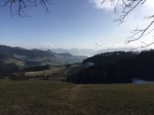
Keen to get out of the Zürich fog and both of us ready for an early (ish) start, Jules and I headed to Wald to repeat one of the first walks we did in Switzerland - to Steg via the Bächtel.
It was lovely weather in Wald when we set off - clear blue skies and slightly hazy in the distance. We climbed steadily - remembering that the walk up is longer than it seems, with lovely views out over Speer and the Glarus valley.
We made the Bächtel in good time - about 90 minutes for the ascent and paused for a bowl of chips and a soup to enjoy the view in the sun.
Recharged and refreshed we headed off along the ridge. The path was a tiny bit icy and slippery in places, but mostly easy walking along the undulating ridges following the path of the Töss below us.
We made good and steady progress to Steg, arriving just in time to miss the train. We relaxed instead with a thermos of tea and a biscuit.
Overall the walk was 14.9km, with 740m/650m ascent/descent and took us 3 hours 30 not including the stop for lunch. The The gpx plot of our route is here, and it remains a very good walk.
Walking Atzmännig - January

With a bit of recent snow, but not really enough to tempt us skiing, Michael and I headed to Atzmännig to try the circular panorama walk.
It was a beautiful day when we arrived - bright and sunny, and much better conditions than the last couple of times I've been. We followed the standard route, which climbs pretty steadily from the base station up into the snow line on the ridge. We were rewarded with the promised views from about half way up the slope from Pilatus round to Speer.
We stopped for a light lunch at the Bergrestaurant Obere Atzmännig (with small cuddles from the dog). Refreshed we continued up into deeper snow on the ridge-line and around the main horseshoe ring. There were spectacular views along the whole ridge-line, from Pilatus to Säntis and the Glarus valley. The route really living up to the promise of panoramic views.
We continued around the ridge, making slightly slow progress. It was hard going in some of the deeper blown snow, and the cols were quite cold in the strong wind. Comments about braving the arctic conditions might have been made. We warmed up a bit once past Chrüzegg and in the lee of the hill, and from there descended quite steeply on muddy paths into the valley. Michael made it almost to the valley floor before slipping over in the mud. Hilarious for everyone who wasn't him.
Overall the 9.4km with 630m ascent/descent took us 2 hours 25, not including lunch and a break. The gpx plot of our route is here.
Skiing Flims - 13th Jan
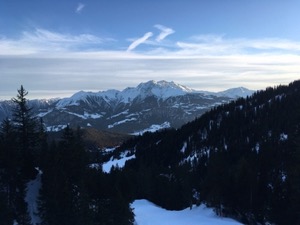
With good weather forecast, but the snow getting a little skied out, Michael and I headed to Flims for a cruise about in the sunshine.
The slopes were pretty empty and with hardly any fuss we headed up the mountain and off on a tour around the resort. We stayed on-piste for the whole day - conditions weren't great off-piste, and there was clear evidence of the resort working hard to move snow around to preserve the conditions on-piste. We had a good morning cruising around, including a loop of the Glacier and the Lavadinas lift before heading over to Stargels for another excellent steak lunch. Suitably fortified we headed back over to the Laax side to to try to hit 50km for the day, for the first time this season.
The best snow was unsurprisingly in the shaded slopes, and in particular the more technical runs which presumably had fewer people on them. We finished a very pleasant, albeit not very technical day on 51.3km, with 8,900m descent over 16 runs. Pleased to have made the effort to go out.
Skiing Flims - 6th Jan
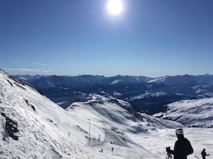
With lovely weather forecast and good snow conditions, Michael and I headed down to Flims for a cruise around in the sunshine.
The day started less than auspiciously when I realised that I'd forgotten to bring my skiing jacket, but with a little improvisation (and being very grateful that I keep a jacket and fleece in the car) we headed off.
We were very lucky with the weather - bright sunshine all day, and plenty warm enough, even in my improvised outfit. We made good progress touring around, the highlight being a run down to Lavadinas from the Glacier on lovely snow. The queues were much shorter than they had been at New Years, and the resort was very quiet and pleasant.
We stopped for lunch in Startgels. We shared a pork cutlet and steak, which were both excellent, although we reckoned that the steak was slightly better.
We had a good day overall - managing 48.5km and 8,500m descent over 16 runs. Unfortunately we had to finish the day by downloading, having mounted an unsuccessful rescue attempt on Michael's goggles.
Walking Teufenthal - January

For the first walk of the year, we headed out with Diana & Luis for a walk from Teufenthal to Lenzburg following the Aargauer Schloss- und Kulturweg
It was a slightly gloomy day when we set off, but we soon warmed up on the first hill which was almost immediately out of Teufenthal. The route certainly lived up to its description, winding through pretty woods and taking in quite a few interesting castles and some impressive natural caves. The weather improved steadily throughout the walk, and by the time we reached Seon it was quite pleasant.
The highlight of the trip was seeing clear evidence of beavers in the vicinity of Birren, just before the outskirts of Lenzburg. They'd been quite industrious and had felled one tree and were making a good start on another couple. We didn't see the actual beavers, but there was no mistaking their work!
By the time we arrived in Lenzburg it had started to cloud over, and we took refuge in McArthurs pub for a rather good English Pale Ale and a perfectly reasonable burger.
All in all it was about 2hrs 40 of walking for the 13.4km with 360m ascent and 410m descent. The gpx plot of our route is here.