Walking Uetliberg - December
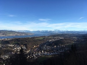
For our last walk of the year, Jules and I headed out on a variation on our favourite Uetliberg walk. We decided to extend the walk a little, and to continue past Felsenegg and drop down to Langnau, working from local maps and signs
With a glorious day forecast and materialising we certainly weren't alone! The train up to Uetliberg was pretty full and there were lots of people out and enjoying the spectacular views. We stopped at the Restaurant Felsenegg for a light lunch of soup and wurst, with the service very friendly as usual. We had no problem with navigation or path and made good progress down to Langnau to catch a train back into town with no hassles, but a short wait in the very nicely appointed waiting room at Langnau station - complete with a sofa and books!
Overall the 12.5km and 275m of ascent / 610m descent took us 2 hrs 35, not including the stop for lunch. The GPX plot of our route is here.
Skiing Flims - December
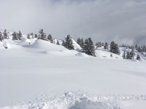
Keen to get out for a first day of the season I headed down to Flims to meet up with Jay & Izzy and hit the slopes.
The snowfall had been pretty good all week, and with a good base down and a promise of sunny intervals later in the day it was lining up to be a cracker. We started with a run down Stretch (it is traditional, after all) on near perfect conditions - freshly groomed powder and almost empty. From there (and legs still working) we headed over to Crap Sogn Gion for a run into Plaun - a bit bumpy and enthusiasm somewhat exceeding ability. We continued on the Plaun side for a couple of runs - a fair bit of the mountain was still closed, but what was open was in pretty good nick.
At about midday we headed back to Plaun station to meet up with Mazda, Jude & family & friends. We did a run down to Flims, stopping to play in the powder above the start of Stretch. Down at Flims we stopped to meet Jules then retired for a rather good burger & chips, before Jules headed off to try the Loipe at Trin. We spent the afternoon around NAgels Side of the mountain including a very cold run down Startgels, and a final blast of Stretch to finish.
All in all Jay & I clocked up about 40km - not bad for a first day of the season.
Birthday Flight - October
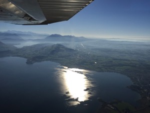
As part of my birthday present Jules kindly bought us a flight around the Glarus region with views of the Glarnish, which I've been thinking of trying to walk up for a while. With a stunning autumn day forecast we headed over to the Flugplat Buttwil to enjoy an afternoon flight.
It was a great time for the flight, the weather was perfect, and the autumn colours were particularly special in the late afternoon, which really made the flight. Overall it was about an hour, including heading to the Glarnish group, and loop around the peaks before heading down the Glarus valley. From there we headed over the Klausen pass before looping back to the Grosser Mythen and back to the airfield.
All in all, a lovely trip out and a very special present
Walking Baden - October
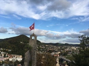
For a bit of a stretch of the legs, Jules, Diana, Louis and I headed to Baden to try a circular walk that takes in the city centre as well as a bit of the surrounding countryside.
The route we followed was from the www.baden.ch website and covers most of the major sights in town as well as around. Being a city walk we were expecting it to be fairly flat, but whoever designed the walk did a great job of including every possible hill they could find! The views over the town are quite impressive from the three major hills around. The route also meanders around the old medieval streets in town, which are quite pretty.
Overall the 9.3km and 400m ascent/descent took us 2 hrs 15 plus one stop for a coffee and cake. The gpx plot of our route is here.
Walking Meilen Forch - September
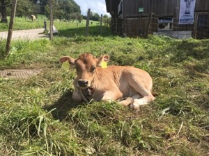
Keen to get out and strectch our legs, but not wanting to travel too far or put too much strain on Jules' leg, we headed to Meilen to do the walk to Forch the opposite way round to usual. This meant a bit more vertical gain, but a route that we knew pretty well, from a slightly different perspective.
We saw some very young cows on route, but they were a bit sleepy in the sun. We also stopped at the
restaurant Pfannensteil (the service still hasn't improved), before popping over the hill and dropping
down to Forch. We arrived just in time to miss the train (couldn't be bothered to run) and with 30
minutes to wait until the next train we walked to the next station at Zumikon (and just about managed to
hail the train).
Overall the 10.5km took us 2 hours with 490m ascent and 230m descent. It's T1 at best, and the plot of our route is here.
Walking Alt St Johann - June
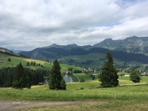
With Jules feeling a bit worse for wear (self inflicted) and with the weather a bit grey and cloudy we headed off to Alt St Johann to try a section from Swiss National Route #48 - Toggenburg Hohenweg
We took the chair up from Alt Sankt Johann to Sellamat. With the weather a bit grey, damp, and with low cloud we stopped for a cup of tea before heading off. En-route we saw some happy ferkels and caught up with the puppy party at Iltois, both to Jules' delight. Deciding that we were a bit early for lunch ,we continued along the well marked Klangenweg, occasionally stopping at the sound stations (where they weren't overrun by children). The weather cleared later on, but unfortunately we never got the full views of the Churfusten or Säntis. We stopped for a good lunch at Oberdorf before dropping down to Wildhaus and then back along the valley to Alt St Johann.
Overall the 11.8km with 150/610 m ascent/descent took us about 4 hours all in including the lift, lunch and breaks. We'd rate it T1, and the GPX plot of our route is here.
Walking Menzingen - June
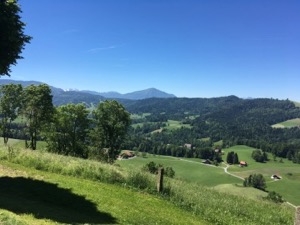
With a beautiful sunny day forecast, Jules and I headed over to Zug to try walk #36 from Rund um den Zuerichsee, a circular walk from Menzingen, taking in some spectacular views of the Rigi and Pilatus.
We set off in bright sunshine from Menzingen after a light breakfast in the backeri in the centre of town. The route heads up to Gubel, where there are the great views of the Rigi, Pilatus and snow capped alps just peaking through the background. From there the route backtracks slightly before eventually looping back round to Menzingen. The highlights of the walk were the Kites which were out in force, plus some ferkels in a barn en-route where we peaked in through an open door. The only slight hiccup on the route was a bit of a navigational challenge at Höllbach, owing to a missing bridge and non-existent path. Deciding that discretion was the better part of valour we took the longer way round, and were rewarded with a cool drunk and wurstli at Höllgrotten Restaurant. before climbing back up the gentle hill eventually to reach Menzingen
Overall the route was 12.8km (including the detour) and 450m ascent/descent, and took us 2:45 of walking, of which a good 15 minutes was devoted to trying to find the path at Höllbach. The GPX plot of our route is here.
Walking Pfaefferkersee - May
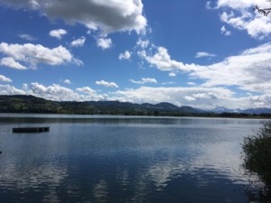
With a lovely day forecast, and keen to stretch our legs a little before Marion headed off for her flight, we headed over to the Pfaefferker See to walk around the lake.
This is a route that we've done a few times, and it's very easy to navigate on well made paths and almost flat for the entire way. The weather was kind to us, bright and sunny and good visibility all the way to the Alps in the south. The lake looked warm and inviting, but the Badis being closed and a distinct lack of people in the water gave a hint as to the likely temperature of the water! The waterbirds were out in force, and we saw a nesting Stork and a very small moorhen chick, in addition to the usual suspects.
Overall the 8.7km took us 1 hr 45 at a fairly gentle pace, not including stopping for a coffee at Pfaeffikon. The GPX plot of our route is here.
Walking Schnebelhorn-Hoernli - April
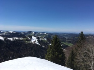
With a lovely day forecast for Sunday on the bank-holiday weekend, Jules and I headed off to try route #16 in our favourite book - Rund um den Zuerichsee, a circular route taking in Schnebelhorn and Hoernli in canton Zurich.
We started in Steg and picked up a snack from the bakery before starting on the walk proper. The route climbs steadily, firstly on roads (with a bit of traffic), then on tracks and finally footpaths. We started to hit snow above 900m, and even saw some very keen snowboarders getting not-so-massive air off self-made jumps. We stopped for an early lunch of good soup at Alpwirtschaf Tierhag before heading up the Schnebelhorn, where we were rewarded with lovely views. From the peak we headed on to Hulftegg, picking our way on paths a bit slippery in snow and slush. We stopped in the restaurant at Hulfteg for a coffee and a water - a bit of a Swiss price moment at Fr. 9.50 for a litre of tap water! From there it was one last push up to the top of the Hörnli - where the views were absolutely stunning views from Säntis to the Rigi and beyond. The descent was lightened by some baby goats (who wanted to suckle), and fluffy rabbits at the farm at Tanz Platz.
Overall the 21.9km took us 6hrs 50 minutes all in, including the 1000m of ascent/descent. The GPX plot of our route is here.
Walking Lachen - April
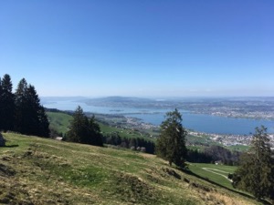
With a beautiful day forecast, and keen to get in a longer walk as part of our training for Nepal a bit later in the year, Jules and I headed to Lachen to try circular route #32 from Rund um den Zuerichsee "Uebers Stoechlichruez".
It was a lovely day, with excellent visibility which was perfect conditions to do this walk as the panoramic views are stunning. We could see as far as the Rigi on one side and Saentis on the other, with excellent views of Speer and the start of the Churfusten. On both the way up and down there were also lovely views along the Zurisee.
We climbed steadily out of Lachen, through meadows and farmland where we stopping briefly to say hello to some very small cows - one of whom was very excited about scratches. We continued to the top of Stoecklichruez with the signal triangle then on to the restaurant at Gueteregg where Jules tried to get over the slight disappointment of no Ruesti. However suitably re-cuperated we pressed on through (almost Mediterranean) woods to the very friendly restaurant Ruchweiden where Jules did get an enormous piece of apple cake with cream followed by cuddles with a very friendly dog to make up for it all.
Overall the route too us 6hrs 15 for 18.8km with 1130m ascent/descent. We'd rate it as the top end of T1. The GPX plot of our route is here.
Walking Forch Meilen - April
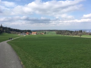
Keen to get out and stretch our legs, we headed to Forch to do a walk over the Pfannensteil to Meilen. We've done this walk before, but it also appears in our favourite book - Rund um den Zuerichsee by Rother, so we thought we'd do it again for old time's sake.
The route was pretty much as we remembered, climbing gently out of Forch through farmland into woodland before passing the Hochwacht restaurant where we stopped for an apple cake and coffee. From there the route continues down into Meilen, passing out of woods and into the town proper. We did a very slight variation on the route down into Meilen this time, for a slightly different view.
The weather was pretty kind to us - nice an bright and sunny with the trees just coming into bud and blossom, but not too hot in the warm spring sunshine.
Overall the 9.6km with 230m ascent / 490m descent took us about 3 hours, including the stop for a coffee. It's definitely a T1, with nothing technical at all. The GPX plot of the route that we took is here.
Walking Rapperswil - March
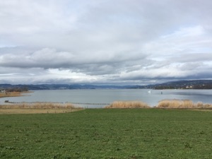
With a slightly miserable day forecast, but keen to get out and stretch our legs a little, Jules and I headed down to Rapperswil on the other side of the lake to walk over the wooden bridge and along the lake to Richterswil.
The route was pretty easy to follow, as it starts out on the wooden footbridge that crosses the lake at that point. According to the signs, there has been a crossing of the lake at that point for a very long time. After crossing the lake the route follows mostly along the lakeside up until Richterswil whereupon we took the train back to town. We stopped for a brief refreshment in the Restaurant Seegut in Baech, which looked quite pleasant and claims to serve fish from the lake.
Overall the 10.5km took us a little under 2 hours (not including the stops), and was a very gentle and flat T1. The GPX plot for our route is here.
Winter Walking Flumserberg - March
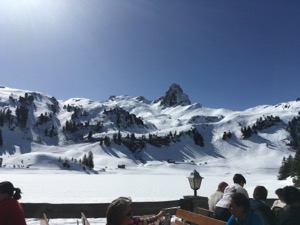
With a beautful day forecast, and feeling that we haven't spent much time in the mountains recently, Jules and I headed to Flumserberg to do some winter walking/snow shoeing.
The chosen route started a way we've been before - parking in Oberterzen and taking the gondola to Tannenboden, then walking along the winter walking route to the Hotel Seebenalp. We stopped at the hotel for a light lunch and then headed on down marked winter route #54 (last year this had been marked as a snow-shoeing trail), dropping back into Oberterzen. The route was pretty easy to follow, although we were quite grateful for the poles marking the route on the second half, as the surrounding hillside is a little intimidating.
Overall the 9.2km took us 2hrs15, and included 300m of ascent and 1040m of descent. We'd rate it T1/2 - slightly technical in places. The GPX plot for our route is here.
Snowshoeing Alt St Johann - February
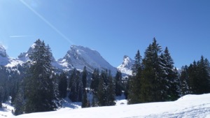
With a lovely day forecast, and my parents tempted to try snowshoeing, we headed to Alt St Johann to try a circular route at Sellamatt.
The route was supposed to be fairly easy, and 5km long, but not having done it before, we had to take it on faith a little. The route was well marked, and wound around just below the Churfusten (which were beautiful in the bright sunshine and snowcapped). However after a while it became apparent that the route marked on the ground was significantly longer than had been advertised on the website. Slightly concerned that we didn't know how much further the route would be, and with two people out for their first trip, we decided to cut the route slightly short and head back via the winter walking path, which was a little faster going, but just as pretty. We stopped for a light refreshment at Zinggen pub before heading back down to Sellamatt.
Overall the 4.8km took us 1hr45, and was fairly technical and hard work for a blue run. Overall though it was a lovely day out in beautiful weather and surroudings.
Skiing Flims - January
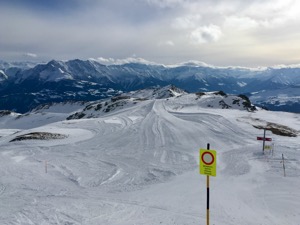
For my first outing of the 16/17 season, I headed down to Flims to take Jay up in his kind offer of a bit of a guide around the mountain.
I decided to take the train and bus to Flims, which was a bit of a long journey, but probably the right call given the weather conditions - fairly heavy snow before and during the day. Even the Post Busses were having to take it a little easy on the way back.
The snow conditions were pretty good when we arrived - lots of snow the previous week meant that there was plenty of powder to play in, but high winds at the top and very flat light meant that there wasn't as much open as there might have been. Still we had a good time on Stretch, and a little bit of a play in the trees.
We stopped for an excellent lunch in La Vacca in Station Plaun - great steak and good wine in a very pleasant atmosphere, and after a slightly sketchy run down we finished with a bit of apres-ski in Flims town.
All in all a good fun start to the season.
Walking Einsiedeln - Jan
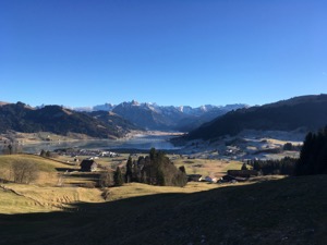
Keen to get out and stretch our legs on a bright and sunny New Year's Day, Jules and I headed (along wiht most of the rest of Switzerland) to Einsiedeln.
After finding a parking space in the fourth carpark we tried, we headed off up the hills behind the monastery to do a circular walk inspired by a route we'd seen in a book, but cut a bit shorter.
The weather was lovely, with bright blue skies, cold, crisp and clear. There were lovely views to the Alps proper and the mountains framing Einsiedeln. The route we picked was a circular route which took in the monastery at the end, where we stopped for a well-earned coffee and crepe in the town square.
Overall the walk was 8.8km, including about 300m ascent/descent. It took us 1hr 50 to complete, without really stopping en-route. The GPX plot of our path is here.