Snowshoeing Brunni - December
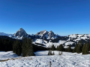
Keen to get out of the Zurich fog and into the mountains for the first time in ages, Jules and I headed to Brunni for our usual start-of-season snowshoeing route - up to the SAC hut and back down.
It was lovely weather when we arrived. We had been slightly concerned about parking, but we were pretty early (for us) and there were plenty of spaces available. We set off gently up the hill, trying to keep to a relaxed pace and enjoying the lovely views.
Upon arrival at the SAC hut we were rewarded with stunning views over the Alps and the Rigi clearly visible poking out behind the Kleiner Mythen. It really was a fantastic day to be in the mountains! We stopped in the hut for a drink before heading back down. We didn't even try to keep up with Aussie shepherd who was chasing his owner down the mountain - the owner having the significant advantage of being on skis, whilst the dog was struggling in the deep snow but seemed to be thoroughly enjoying itself.
We arrived back early in the afternoon to complete a lovely first day out snowshoeing for the season. Overall it took us about 1 hour 50 (not including the break) for the round trip of 4.8 km with 460 m ascent/descent.
Walking Birmensdorf to Dietikon - November
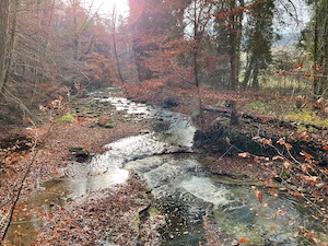
Keen for a stretch of the legs but not wanting to travel too far, Jules and I wrapped up warm and headed to Birmensdorf to try route ZH050 from https://www.zuercher-wanderwege.ch/
It was a bit grey and dull when we arrived, but we were expecting that, and we headed off in good spirits, glad to get out. The route was fairly easy, following the Reppischtal to and then through the military area. We stopped briefly to admire some well-designed chicken coops (I neglected to note the manufacturer - might have to go back to check that), and then headed up the hill into the beech woods.
The route was fairly quiet but perfectly pleasant for that. We strolled past many ponds as we followed the stream, with the usual waterfowl braving the winter conditions. It started to snow just as we arrived in Dietikon, which was added to our brief wander through the Christmas market to finish off the walk.
It was good stretch of the legs - easy to get to from Zürich and a good winter route. It could also be particularly pretty in autumn when the leaves are changing in the beech woods. Overall it was 9.9 km with 220 m ascent and 320 m descent which took us 1 hour 55. It's an easy navigation T1, and the official gpx plot of the route from https://www.zuercher-wanderwege.ch is reproduced here.
Walking Brugg to Baden - October
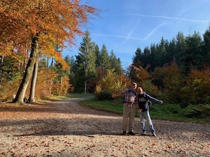
With an uninspiring grey drizzle forecast, but keen to head out for a stretch of the legs. Jules and I headed over to Brugg to meet up with Diana & Luis to do a variation on #38 "Gebenstorfer Horn und Wasserschloss" from the Aargau book by Rother.
It was rather foggy on the journey there, but fortunately it had brightened up by the time we started, and we were treated to good late autumn weather for the whole walk.
We did the route in reverse from the book, and first headed to the Aare and then followed the north river bank until near Vogelsang/Wasserschloss where we cut across to join the Limmat briefly. From Turgi we headed up to Gebenstorfer Horn where we stopped for lunch at the lookout point and enjoyed the views over Wasserschloss. and the surrounding hills.
Suitably refreshed we headed along the ridge following national route 5 - Jura Hoheweg. We had done this section before (I thought it looked familiar) as part of a two-day walk in May 2016. We stopped for a coffee and cake in Baldegg - along with many other people who also had the same idea of enjoying a drink in the late autumn sun.
We arrived in Baden via the obligatory path through the castle ruins and dropped into the old town for a quick drink to finish off a lovely day out - just what the doctor ordered. Overall it was 14.2 km with 290 m / 220 m of ascent / descent and took us about 4 hours 40 including a stop for lunch. The gpx plot of our route is here.
Walking Illnau to Nänikon - October
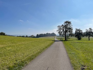
Fancying a gentle walk, with without travelling too far, Jules and I headed to Illnau to try route #83 from the yellow book Zuercher Wanderwege / Wanderungen in der Schweiz 2021/22.
We started out from the pretty village of Illnau, and were soon out into the gently rolling hills of the Zurcher Oberland.The route winds through a small nature reserve and then through woods and farm land - very typical of the area. The views weren't as good as they could have been with a haze obscuring the peaks in the distance. The sun was shining, and it was lovely and warm despite the low headline temperature. We made steady progress to the very pretty town of Nänikon on the Greifensee.
It was a lovely walk and just what we needed in terms of a gentle stretch of the legs without any stress and easy travelling by public transport.
Overall it was a bit less than 10 km and took us 2 hours 20 minutes going fairly gently. The gpx plot of our route is here.
Walking Menzingen - September
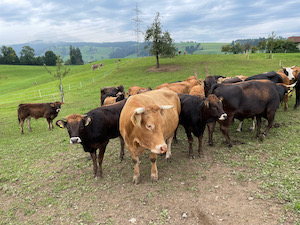
With slightly worse-than-hoped-for weather forecast but keen to get out, Jules and I headed over to Menzingen to meet up with Imke and do walk #36 from Rund umd den Zurichsee - Menzingen circular.
It was a day of diversions both on the drive there and also right at the start of the walk, but after finding our bearings (and an open path) we headed off. We decided to do the route in the classic direction and first headed up to the Kloster at Gubel. We picked up some bits and pieces in the hofladen at the Kloster, the smoked sausage in particular turned out to be very good indeed. From the Kloster the route winds through farming land above Zug, and we saw quite a few very young cows - some surely only a few days old. Jules was particularly excited by seeing some piglets who seemed to be quite content and living in good conditions.
Heading out of farmland and down into the gorge we continued to Höllbach to the restaurant near the caves. We stopped for a rather good lunch of fairly traditional Swiss food (Rösti being a popular choice around the table), but we didn't hang around too long as there were a few drops of rain to hurry us along.
Feeling slightly weighed down by lunch we started up the hill to return to Menzingen - a bit of a shock on full stomachs. We made steady progress however and the sun came out about half-way up which was very pleasant.
We arrived back in Menzingen to finish off a gentle 12.9 km with 430 m ascent / descent at a leisurely pace of 3 hrs 30 which included breaks and photos but not lunch. The gpx plot of our route is here.
Walking Panixer Pass - September
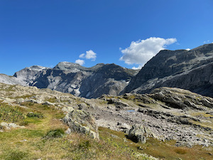
With conditions finally right I headed off for my planned route of walking over the Alps. I started from the southern end of the Glarus valley and headed over the Panixer pass and down into the Vorderrhein valley in Graubünden.
The journey there was a bit of a faff. I took the train from Zürich to Ziegelbrücke and changed for the train to Schwanden. From there I caught the bus to Elm, and then changed busses (or rather didn't - it's the same bus, but the number changes which caught me out a bit) to the base of the pass. Fortunately the public transport was up to the usual Swiss standard and although the journey was long and a bit complicated it all went smoothly.
It was lovely weather when I headed off, blue skies but still cool in the shadow of the mountains which made for a very pleasant ascent. I saw a few people en-route including two couples behind me and two groups of two coming the other way, but otherwise it was a pretty quiet day.
The landscape changed from lush green in the valleys to pretty barren at the top of the pass. There were a couple of sections still with snow even in September, but mostly it was dry and easy walking on well trodden paths. I made pretty good time taking breaks fairly frequently on the way up, and I arrived at the Panixer Hut at about lunchtime having taken approximately 2.5 hours for the 1,350 m of ascent.
It was very quiet and peaceful at the top. The weather was good, and I relaxed in the sun for a little while enjoying the view. There wasn't much in the way of wildlife up there - a few small birds (sparrows, I think) quite a few butterflies and some alpine flowers including Wolfsbane which I don't think I've seen before.
The route down to the Vorderrhein was a bit more technical than the ascent. It was a tiny bit slippery on the slate path coming down off the pass, and there are a couple of sections with severe drops above Lag da Pigniu but protected by chains and with fairly wide and safe paths. I made good time down to Panix where I declined to wait for the bus and instead walked down the road to Rueun to catch the train. I had forgotten how pretty the train ride back along the Vorderrhein valley is, particularly the tectonic area near Versam which was a real treat to finish off the day.
Overall it was about 25 km of walking with 1350 m of ascent and 1,830 m of descent. It took me about 6 hours 35 for the whole walk including the breaks and rests. I reckon it's a hard T2, and the gpx plot of my route is here.
I'm very happy to have done this route, particularly after having planned and trained for it a fair amount. It was definitely worth all the prep!
Walking Sunnenhörnli - August
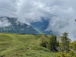
For my last training / calibration walk in preparation for Panixer pass I headed off to the Glarus valley to try route #40 from the green Rund um Zurich book from Rother - Sunnenhörnli.
It wasn't the best weather for a high walk - there was the threat of rain and the clouds did roll in right at the peak, but I decided to do the walk anyway - the point being mostly to test myself against the climb and the length. It was a pity not to see the views since I suspect that these would have been very impressive, but there's always next time!
The route starts from the village of Engi and climbs pretty steeply for the first half of the walk (then descends steeply for the second half - another of those walk where you barely take a flat pace all day). The conditions underfoot were quite muddy with the recent rain and the choice of walking boots was a good one.
I made good time on mountain roads until the branch and the final ascent graded T4. Obviously I was a bit more cautious on that section, particularly with the clouds rolling in, but I made it over the slightly tasty section without real mishap, and quite pleased with myself.
The plotted route from the book continues on about 400 m past the Sunnenhöreli peak onto the next small peak (unnamed) before turning off the marked path and passing the very small Chämmliböden pond and continuing down back to the marked white-red-white path. It felt quieter off the track, and I saw two large marmots which made me very happy.
Once back on the marked path I made steady progress down to Gamszinggen and there picked up another mountain track back down into Engi. There were some rather spectacular rock formations in the valley. It looked like laminated slate had been carved out by the river in very distinctive striated formations.
I arrived back at Engi having taken 5 hours and 5 minutes (all in) to complete the 16.2 km with 1,470 m of ascent/descent. It's mostly a T3, the section up to Sunnenhörli is marked white-blue-white, but I'd rate it as T3+. I was carrying more equipment that I needed, but that was the right decision. I wanted to check that I could make the distance and height with a full pack, and it's always worth carrying equipment above 2,000 m. The gpx plot of my route is here.
Disaster nearly struck on the journey back home. The regional bus was 8 seconds late arriving in Engi, but since the clock still showed the correct minute on departure, we’ll forgive them. However, the problems compounded when a passenger at the next stop needed to buy a ticket costing valuable seconds and threatening to throw the whole timetable into disarray. Fortunately the driver was up to the challenge and made up the lost time by descending like a maniac and arriving at Schwanden on time. Thank goodness for that.
Walking Mutteristock - July
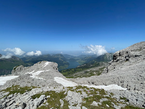
With a good day forecast I took the opportunity for another training / calibration walk in preparation for Panixer Pass later on in summer. The chosen route was #25 from Rund umd den Zurichsee, up the Mutteristock at the southernmost end of the Wägitalersee.
After finding an open road to the start of the walk I parked and headed up the hill. Unfortunately my legs aching after 10 minutes (cycle ride the previous day, I suspect) which didn't bode well for a long day with lots of height! The route climbs steeply and fairly constantly for the entire ascent, then reverses and descends in the same vein. There’s barely a flat step the whole day...
It was a bit wet and muddy underfoot recent rains, particularly in the lower sections of the walk. Once up into the rock fields nearer the peak it was much drier, or still frozen snow.
The suggested route up from the Lufthütte to Mutteri was overgrown and clearly not regularly used. I wonder if the official path has moved to go towards Lauibüel before backtracking under the farmers' cablecar. The book has been excellent, but is now nearly 10 years old, and the routes do change slowly over time. Undeterred I rejoined the main path and headed on up, the path turning from mud to rock as I climbed.
The last part of the ascent is over very rough ground - chemically eroded limestone creating vertical shards and holes - very hard on shoes and on tired legs. The final 200 horizontal metres took nearly 10 min each way, having to pick each step with care.
I did make it to the peak, but with cloud starting to set in I made a hasty retreat down past Torberglücke to have lunch beneath the forming clouds. Once down off the peak I was much faster on the descent, and the ground had dried out a bit during the day which was a relief.
Overall it was a good training / calibration run. It's 1300 m of ascent/descent and 11.8 km which took me 5 hours 35 all in. I finished my 2l camelbak of water in 4 hrs, and I'll need to carry a bit more for longer walks. I was pleased to finish with no notable aches or pains, even my left knee held up just fine despite the very challenging conditions. The gpx plot of my route, including taking the marked path down in the direction of Lauibüel is here.
Beer Hike Homberg - July
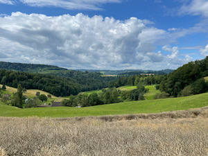
After much debate and discussion between the girls, the inaugural beer hike was chosen to be #25 from the "Beer Hiking Switzerland" book - Homberg.
Taking the controversial decision to do a beer hike with the suggested restaurant closed (can it really be a beer hike with none of the official beer?), but listening to the instructions of the girls - apparently it was "complicated"- we headed off with barely a grumble.
The route is very pretty as it climbs out of Seon and soon into the rolling hills to the east of the Hallwillersee. There are no steep climbs on the route, but it does have sufficient hills to feel interesting and to give lovely views on occasions.
We arrived in Oberflügelberg to confirm that the mountain restaurant Homberg was indeed closed. Fortunately Luis saved the day by providing some of his excellent home-brewed beer thereby saving the honour of the walk.
After a brief look around the Hochwacht we headed on down to Lenzburg where the girls decided to go for a coffee and a cake and the boys chose to continue to sample the beer. Unfortunately none of the "official" beer for the walk - the local Seetaler - was available at the venue, but we managed to compensate.
Overall it was 15.7 km and took us 4 hours 30 including the stop for lunch & breaks. It's a total of 550 m of ascent and 460 m of descent and the gpx plot of our route is here.
Walking Bockmattlistock - July
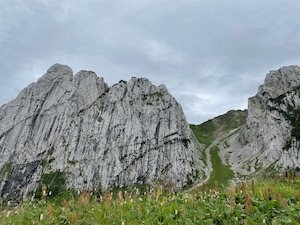
With a slight break in the rain forecast (which turned out to be a lie), I headed over to the Wägitaler see to try route 26 from the favourite book Rother / Rund um den Zurich See. I was hoping for a good stretch of the legs and also as a training calibration run for Panixerpass which I hope to do a little later in summer.
After parking in Innerthal I headed up the hill, climbing easily on roads at first and then onto woodland paths. The forecast sunshine turned out to be grey cloud with occasional showers, but the drizzle never really turned into rain. The path became a bit steeper above the Bockmattlihütte, climbing up to the Bockmattlipass.
Unfortunately the section of the walk from Bockmattlipass to Furgge had been reclassified as T4 and specifically noted as not to be attempted when there was snow on the route, which there was. Although the path wasn't very clear it also seemed to traverse a steep grass slope which I expected to be very slippery given the rain.
I took the route up to the top of Bockmattlistock whilst I considered my options, and I did go a little way along the T4 section, but turned back when I decided that the path was getting a little too difficult. I'm glad of the choices - made it down safe and sound, and also had a little look and go at a more challenging piece.
All in all it was a successful training calibration walk in preparation for Panixerpass. I’ll do another few of these, avoiding any T4 or higher grade routes. The only concern was a slight pain in my left knee on the descent - a running injury that I’ll need to keep an eye on. Overall I took 4:30:00 to complete the 13.0 km with 1040 m of ascent/descent including breaks, photos and checking out the difficult sections. The gpx plot of my route is here.
Walking Eigenthal - June
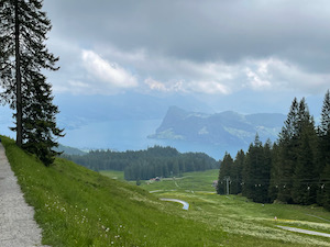
With a good day finally forecast, Jules and I headed to Eigenthal in Lucerne for a walk near Pilatus.
After a slightly more challenging drive there than we expected (the satnav routed us up a very narrow, possibly forbidden track), we parked up easily in Eigenthal and headed off.
The route climbs steadily at first, and then more steeply up through woods to arrive at the highest point at the base of the Klimsenhorn. From there we headed mostly flat past the gondola station at Fräkmüntegg with a very exciting looking tree walk area, and a little further on we saw a few types of orchid growing in the marshland by the side of the path (we were a little sad, because this would have been about the time for the traditional Orchid walk in Jena).
We stopped for lunch at Berghaus Mülimäs (which is further on from Mülimäs, we discovered) before descending and looping back to the crossroads at Chräigutsch. From there we took a slightly different route back, over Würzenegg and back to Eigenthal.
Unfortunately the clouds didn't lift for most of the day, so we didn't get the full views of Pilatus, but it was still a lovely walk, and we must do it again in better visibility. Overall the route was about 13 km, with 800 m of ascent/descent. It's a T1+, and took us about 3 hours 45, not including lunch. The gpx plot of our route is here.
Walking Stäfa to Rapperswil - June
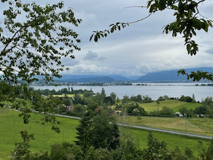
With another grey and wet day forecast, but keen to get out for a stretch of the legs, we headed to Stäfa to meet up with Imke and walk to Rapperswil, following the usual route #19 from the Rother book "Rund um den Zurichsee".
It was overcast but not raining when we arrived at Stäfa. Suitably optimistic we and headed off on the now well trodden route. The views were a little less impressive than usual, owing to the low cloud, but it was still a good stretch of the legs.
We made good progress to Rapperswil without really stopping. We took the loop around the castle by the river just to see the sights (a worthwhile addition, which I think we'll do again) before heading into the town square. There was a bit of a disaster on arrival with the realisation that our favourite coffee shop closed at some point during lock-down, so Jules was deprived a post-walk cake!
Overall it was 11.8 km with 215 m of ascent/descent which took us 2 hrs 35 (not including the few stop and breaks). The gpx plot of our route is here.
Braeteln Luzern - May
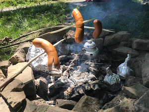
With a lovely day forecast and keen to get out for a sociable stretch of the legs, Jules and I headed over to Luzern to go Bräteln with Janine in the hills above the city.
We parked in the centre of town and headed off up the Sonnenburg in bright sunshine. The views were spectacular all day - in particular the Rigi and Pilatus were in great form - snow-capped and bright in the sunshine.
We found a fire pit fairly easily despite the good weather and settled down for Cervelats cooked on sticks with pita bread wrapped in foil in the cooler embers (which worked really well).To accompany we took some pasta salad and baba ghanoush, and finished off with roast peaches washed down with mint tea. Delicious!
After lunch we continued on for a walk around the Sonnenberg ridge, stopping briefly to try out Janine's new hammock (after we found some trees the right distance apart). The woods are very pretty - a mixture of evergreens and deciduous and all fairly carefully managed without looking overworked.
In total the walk was 11.8 km with 430 m of ascent / descent and took us 2hrs 40 plus a long relaxed lunch. The gpx plot of our route is here.
Walking Wildegg to Aarau - May
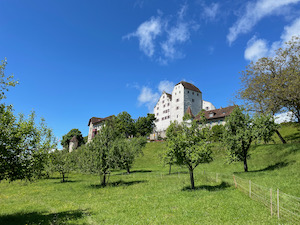
The forecast for Sunday was dry and brightening up in the afternoon, so Jules and I headed over to Aarau to meet up with Diana and Luis for a gentle walk along the Aare.
Unfortunately the forecast didn't quite come to pass. It was raining as we left home (umbrella in hand) to catch the train. That wasn't the last of the rain for the morning - there were another couple of heavy showers and the sun didn't really come out until after lunch.
However, we made the most of the conditions and started off in the wrong direction with a brief detour up to the Schloss Wildegg. We didn't go in to see the falcon show, but we did spend a few minutes admiring the birds. We then headed back down to the Aare, which we then followed all the way back to Aarau. The river was very full from the recent rains and the flow over the weirs was quite impressive. It's a very pretty and quiet walk along the riverbank and there were plenty of people out and enjoying the day.
We stopped for a short lunch break in the sun at the Kraftwerk at Brachmatt where the sun finally came out for the afternoon. We saw some very young cygnets near Rüchlig, with quite a few admirers looking on.
It was a lovely walk despite the occasional rain showers. Overall it was 17 km with 200 m a/d and took us 3 hrs 30 plus the break for lunch.
Walking Meilen to Stadelhofen - May
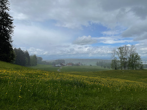
With a blustery, showery day forecast but keen to get out for a stretch of the legs I took the train from town down to Meilen to walk over the Pfännensteil and back to town via Forch.
It was dry when I arrived at Meilen and I set off up the hill taking the path by the stream as it winds up the hill. The visibility was better than I expected from the forecast - the Rigi and Pilatus both (just about) visible on the way up.
It was very quiet, with only a few dog walkers out. I was lucky enough to see a deer in the wood just below the Pfännensteil as well as a robin, a buzzard being mobbed by crows, and as lots of finches and tits.
The weather stayed dry until past Hochwacht, but then I caught the first of two storms halfway to Forch. Undeterred, I headed on only to be caught in a second, heavier rainstorm as I passed the golf course. I dried out gradually over the rest of the walk, fortunately with a few sunny spells to help me keep warm as I dropped down along the Pfadiweg back into town.
Overall it was 22 km with 550 m ascent / descent and took 4 hrs 15. I like this route which is always a good stretch of the legs despite the prevailing conditions on the day.
Walking Sihltal - May
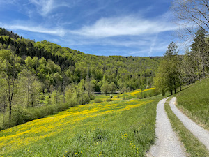
With a glorious day forecast Juliane & I headed to Sihltal to do walk #45 from the favourite book Rund um den Zurichsee - "Über den Hirzel nach Sihlsprung"
We parked at the old Sihlbrugg railway station and headed on up the hill in bright sunshine. The route climbs steadily at first up through trees and then out into open ground on the way to Hirzel. The views were absolutely spectacular, with the mountains very clear from Saentis to Pilatus and well beyond.
We paused briefly to admire some Moss Phlox and to buy some Swiss priced soap at Naturduftseifen, before heading on to Hirzel. We stopped at Restaurant Spreuermühli where we stopped for a quick drink - very happy that they're able to open again and to support them. The route then continues on down to the Sihl near Sihlsprung before heading down river to Sihlbrugg. The last stretch along the side of the Sihl was particularly pretty, with dandelions and meadow buttercup in full bloom.
Overall it was 17.4 km with 470 m ascent/descent and took us 3 hrs 30 (not including the stops and breaks). The gpx plot of our route is here.
Walking Döttingen - April
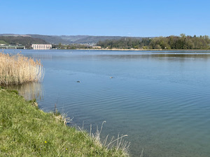
With a lovely day forecast and keen to get out for a walk, we headed over to Döttingen in the north of Aargau to try walk #32 from the book Rother Wanderführer Aargau with Diana & Luis.
It was beautiful sunshine when we arrived, and we headed off along the side of the wildlife sanctuary for birds at Klingnauer Stausee. Being late spring there weren't any migratory birds, but we did see a few swans and other waterfowl. We followed the route along the side of the sanctuary and all the way up to the Rhine, past the large hydropower station where we stopped for a quick break. before heading up to the Rhine, and crossing the Aare.
The route back down the other side of the Aare was closed, so we took the signed detour past Koblenz station before re-joining the Aare near the hydroplant. We left the Aare at Klingnau and after passing through the pretty town centre we climbed up into the woods and past Acheberg. From there we dropped into the Rheintal to complete the walk in Bad Zurzach. We were just in time for a train back to Döttingen where we found an open beer garden (hurrah!) for a refreshment and a rather good pizza to finish off the day.
In total it was 16 km with 280 of height gained/lost and took us 3 hrs 20 (not including the breaks and lunch). It's an easy T1 and the gpx plot of our route is here.
Walking Küssnacht to Lucerne - March
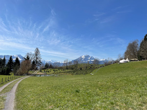
With a stunning spring day forecast and keen to do a decent walk Jules and I headed to Küssnacht am Albis to meet up with Diana and Luis. Being still early in the year all the high paths were still snow covered, so instead we opted for a walk that we've done before - a route that broadly follows the lakeshore to Lucerne.
As usual this walk didn't disappoint - the views were spectacular in the bright and sunny spring day, with the snow-capped mountains visible far into the distance. Being fairly early in the year it wasn't too hot and overall it was perfect conditions for a good walk.
We made steady progress, stopping occasionally for photos of the Rigi and Pilatus. We ate our lunch overlooking the lake near Magdalenekirche, and stopped again a coffee and cake near the Lucerne Lido.
Overall it was 17.4 km with 380 m ascent/descent and took us 3 hours 40 (not including the breaks). The gpx plot of our route is here.
Skiing Flims - March (part 2)
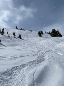
Keen to head out, and hoping for better weather than forecast, Alex, Christian and I headed down to Flims for a day of skiing. The snow conditions were forecast as excellent - lots of snow recently and quite cold to keep it in good condition.
Unfortunately it was quite windy when we arrived, and the whole top of the mountain was closed. We headed around a bit trying to find the best conditions and did a run down skiroute #83, but found it a bit windblown. However, we did see some people heading over to the far skiers-left, so we followed them, and ended up doing some off-piste gladed runs, which were great fun albeit quite technical. The runs end up in a very narrow single-track run down by the stream which runs to Plaun and was a bit tasty on powder skis. We did this run a few times, taking slightly different routes each time.
We also found some quite good conditions off to the skiers-right of route #66 which heads down from Crap Sion Gion to Plaun. This area and the off-piste kind of made up for the disappointment of the rest of the mountain being closed.
Overall we made the best of the conditions on the day, and ended up with a perfectly respectable 44.4 km with 7,600 m of descent over 12 runs.
Skiing Flims - March
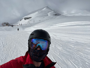
With the weather forecast less than perfect, but keen to get out at least once in the season, Alexander and I headed down to Flims to try a day of skiing despite lockdown.
The resort seemed to be handling Covid measures pretty well. We did have to buy a ticket in advance, but that wasn't a particular hassle. It was definitely quieter than usual, with almost no queues for the lifts, and we only shared one lift all day.
The visibility was a bit mixed as we headed up, and was quite bad at the top of Crap Sogn Gion, so we headed down and did a run all the way to Falera for a bit of a warm-up. From there we decided to try out the glacier and were pleasantly surprised when the visibility was much better at the top of the mountain. We did a couple of runs down the glacier in awesome conditions - lovely snow and even a bit of fresh powder off to the side. We then headed down to Plaun for lunch - a surprisingly good take-away ciabatta from the bar, and sat in the snow while the sun came out.
After lunch we did the black run #26 down from La Siala (which was in great condition) and skiroute #83 from the top of the Crap Sogn Gion (which was also in great condition). We finished with a long run down from La Siala via Grauberg and Startgels to finish off a really great day.
Overall we managed a pretty respectable 54.8 km, with 9,200 m descent over 15 runs, to finish tired but happy to have made the effort to get out.
Snowshoeing Elm - February
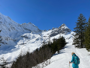
With great weather forecast and keen to get to the mountains, Jules and I headed to Elm in Glarus Süd to try snowshoeing route 990 from www.schweizmobile.ch - the Obererbs trail.
It was a pretty easy drive from town - now as busy as we feared. We parked at the unfortunately closed restaurant Panixerstübli and started up the hill. The route climbs steadily (ouch) up through woodlands and then into an open valley with spectacular views of the Vorab, Hausstock, and Mättlenstock.
From there the route continues to climb (more ouch) up to the Skuhütte Erbs, which was well frequented in the sun. We stopped for a Most to support the hut and sat in the snow with our sandwiches. Suitably refreshed we continued down through the woodlands to loop back to the car.
It's a lovely little route, with spectacular views right in the heart of the Alps. It's a bit punchy at the start, and the trick is probably to take one's time on the ascent. In good weather it's a spectacular and lovely day out. Overall the 4.6 km with 400 m ascent/descent took us 1 hr 30 (maybe that's why it hurt), and it's a T2. The gpx plot of our route is here.
Walking Turgi - February
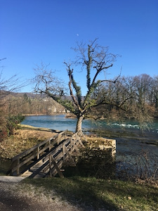
With a promising winter's day forecast we met up with Diana & Luis to do a walk around Turgi, kindly organised by Diana.
There was quite thick fog when we arrived, so we decided to walk along the river, and save the ascent of the hill to later in the day in the hope of better views. We crossed over the Limmat and then headed downstream following the east bank, past the merging with the Aare.
The sun had burned through the fog by the time we stopped for lunch near the PSI institute, and we took a short break there before crossing over the Aare and heading back upstream on the west bank. The experiment with enjoying a cigar whilst walking was only partially a success - the girls setting a pace that made for slight difficulty keeping the cigars alight whilst walking and talking, but it made for a nice change. We continued in bright sunshine and lovely weather back to Vogelsang where we stopped for a lovely slice of Diana's rhubarb cake and a kaffee fertig.
From there it was just a short walk back to Turgi, with no-one particularly inclined to walk up the extra hill for the views!
Overall it was a very pleasant and relaxed 15.3 km with 180 m of ascent/descent and an easy T1. The gpx plot of our route is here.
Snowshoeing Biberegg - February
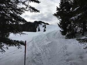
It wasn't the best day to go snowshoeing - the originally anticipated sunshine giving way to grey cloud, but keen to get out I headed over to Biberegg to try route-0815 from www.schweizmobile.ch.
I parked at the small ski lift in Biberegg and headed up the hill following the typically well signposted path. The route climbs steadily through farmland and then into woods, where I joined the route that we have done previously. At the top of the climb I was treated to spectacular views over the Rigi, alps and Vierwaldstaettersee, which we hadn't seen teh last time.
I had lunch admiring the view and watching the skiers (the resorts seemed to be well frequented), before continuing and dropping to Herrenboden. From there decided to do the extra loop around Mostelberg since I was making good time. I took a slightly different path (which was a bit off-piste), and was quite grateful to come out eventually right by the top of a drag lift before heading over the skybridge and back on down to Biberegg.
Overall the day was 13.6 km and 800 m of ascent/descent which took me 3 hrs 25 minutes moving time - so a fairly good day snowshoeing. It's a T2 (I reckon) and the gpx plot of my route is here.
Walking Bubikon - February
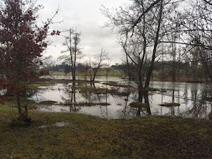
With a bit of a dull day forecast, but keen to get out of the flat and stretch our legs, Jules and I headed off to do a variation on walk #12 from our favourite book Rund um den Zuerichsee.
It had been forecast to be dry for a few hours, but that only lasted for the first stretch, and it was raining pretty steadily by about a third of the way. We decided to cut the route short and to head back - neither of us particularly inclined to get soaking wet.
We did manage to see some Storks at the Luetzelsee - to our slight surprise, and the route was perfectly pleasant winding through small woods and farms in fairly rural ZH.
Overall it was 13.8 km and 220 m of ascent/descent and took us 2 hrs 35 with only one stop in a forest hut to have a cup of tea and some of Ernst's cake (which was very nice). The gpx plot of our route is here.
Walking Baden - January
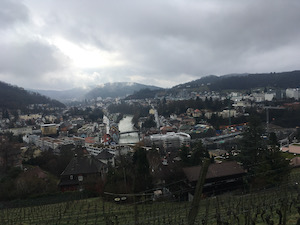
With a pretty uninspiring day forecast, but keen to get out and be a bit sociable, Jules and I headed over to Baden to meet up with Diana, Luis, and Imke to do a short walk around the city.
The weather was as bad as forecast - light drizzle earlier in the day but brightening up a bit later. We headed off to do the city walk that we had previously done back in 2017, but reckoned from the outset that we might only do the first half.
The views over the city were fine, and the route is still good, but the weather made it a bit less enjoyable than it could have been. We arrived back in Baden after a bit over 5 km, and decided to head down to the river front for a cup of tea and biscuits, rather than do the second half of the walk.
It was nice to get out for a bit, and to meet up with some friends after having spent most of January in lock-down, even if the weather wasn't brilliant.
Overall it was a pretty short walk - 5.6 km with 270 m ascent/descent which took us 1 hr 25 minutes (plus a lot more time chatting). It's an easy T1 and the gpx plot of our route is here.
Snowshoeing Brunni - January
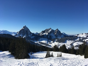
With a beautiful day forecast in the mountains, and keen to get out and enjoy it after a few days of grey in Zurich, I headed over to Brunni Alpthal to go snowshoeing.
I chose the longer route, as I wasn't in much of a hurry and conditions were lovely. The route was slightly longer than I had planned (owing to a slight navigational error [cough]), but it was all alright in the end.
I made good time up to the Furgellenstock hut. It was closed this time, but I ate my lunch in the sun on the benches outside. Refreshed, I continued on up to the top of Furgellenstock, which was quite well frequented with people enjoying the stunning views across the Alps.
From the peak, I continued around to top of the cablecar at Holzegg (inadvertently going via the skihaus Holzegg at the very top, and nearly heading down the toboggan run), but I made it safely around, and then it was an easy descent down to the valley.
It was a lovely day out, with spectacular views in great weather. The forecast temperature was quite cold (-10 °C) but it felt warm in the sun, and I spent most of the day in the tried & tested shirt + baselayer combo. The route was 10.1 km, with 750 m ascent/descent and took me 2 hrs 35 plus the stops for lunch and photos. The gpx plot of my route is here.