Walking Uetliberg - December
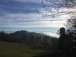
With fog covering the lake, but the promise of sunshine slightly higher up Jules and I headed to Uetliberg to do our standard walk along the ridge to Felsenegg. We have a bit of a soft spot for this walk, because it's one of the first walks we did together in Switzerland, just when we first arrived (and things were a bit hectic).
The conditions were perfect - crisp and clear, but not to cold, with bright skies and the fog just
spilling up the hills from the lake. We took the train from HB up to Uetliberg, and the then the usual
combination of cable-car down from Felsenegg and then train back into town from Adliswil.
We weren't going particularly quickly, and the 5.8km took us 1 hr 10 at a gentle pace. The route is very easy to follow, but our plot ishere.
Walking Zugerberg - December
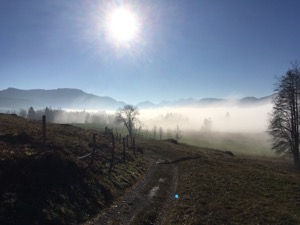
Looking for some nice weather above the forecast low cloud at about 700m, Jules and I met up with Diana and Louis to try a walk on the Zugerberg.
After a ride up in the bergbahn we set off, broadly following the Hirsch route in reverse (on the advice of the lady in the station). We started out just about at the cloud level, but as we headed up we were rewarded with beautiful views of the Rigi and Pilatus rising out of the low cloud. The weather was lovely for us, and we followed a gentle circular route on well made paths and tracks with lovely views around. The area would be very nice for most of the year, with opportunities for winter walking or snow-shoeing plus a cross country ski route. We stopped for a perfectly acceptable late lunch at the bergrestaurant Hintergeissboden before heading back down to (just) catch the train down. Overall a lovely day walking in great conditions, and well done to Jules for picking it.
Overall the 14km with 370m ascent/descent took us just shy of three hours, plus one break and lunch. The GPX plot of our route is here, although the whole area seems navigable.
Walking Staefa to Rapperswil - November
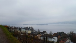
With fog forecast up to quite a high level (and not fancying a long drive) Jules and I headed slightly out of Zurich to Staefa to walk along the Gold Coast to Rapperswil.
In better weather the views would have been very good, and they weren't too bad in the low cloud/fog on the day. The route meanders through the vineyards and villages scattered along the coast, never too far from the lake but rarely right beside it. The route from the book is pretty easy to follow, but in truth a vague sense of direction and knowledge of what order the villages come in is all that's needed for the route. We finished up in Rapperswil for a surprisingly good late lunch in the Burgcafe in the Hauptplatz - a very good Egliknusperli for me and a pannini for Jules.
We completed the 11.9km in a bit less than 2 hrs 30, without really stopping for breaks. It was nice to get out for a gentle stroll, nothing very adventurous along this route. Our GPX plot is here.
Walking Kybourg - November
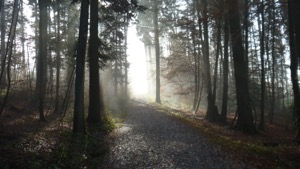
With a pretty marginal day forecast, but keen to get out for the first time in a little while, Jules and I headed to Winterthur to try route #8 from Rund um den Zurichsee.
The route heads out of Winterthur pretty quickly and climbs steadily to the outlook at Gamser where you get the first view of the castle Kybourg. From there you drop down to the river Toess before climbing the 666 steps up to the castle. We had a good lunch at the Restaurant zur Linde before looping back to Winterthur. The highlight of the route for Jules was seeing the Wildschwein in the Wildpark Bruederhaus, although they were definitely too big for cuddles.
Overall the 14.6 km took us about 5 hours all together, including a long stop for lunch. It's a T1, and fairly easy except for the steps up to the castle. The GPX plot of our route is here.
Walking Gottschalkenberg - October
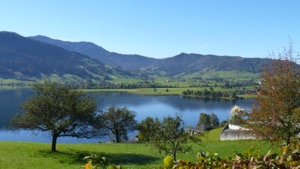
With a foggy day forecast in Zurich, but the promise of brighter conditions a little higher up, Jules and I headed to Oberaegeri to try a walk from a the new book "Zuercher Wanderwege / Wanderungen in der Schweiz 2016/17", that we bought on a the last walk.
When we arrived in Oberaegeri we found that there was almost no fog, and with very clear air there was the promise of spectacular views on the walk. We started with a steady climb up with views over the lake, and we were treated to the first views over the Alps. The panorama walk continues in a big loop, mostly looking over the Aegerisee for the first third before heading to Gottschalkenberg with views over the Zurisee (which was still covered in fog). From there the walk loops back via Raten where we stopped for a late lunch before dropping back down to Oberaegeri to complete the circuit.
Overall the 18.4km took us 3 hrs 50 minutes, plus a stopping for lunch and breaks, and included 700m ascent/descent all at 4 * / T1. The gpx plot of our route (including the slight detour to get to the viewpoint at Gottschalkenberg ) is here.
Walking Pfaeffikon Circular - September
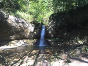
For a bit of a stretch of the legs (but not wanting to go too far or do too much), Jules and I headed over to Pfaeffikon to try route #13 from Rund um den Zurichsee.
We arrived after a slight navigational challenge (wrong Pfaeffikon), but soon headed off on our way. The route starts from Pfaeffikon station, and climbs gently through very pretty woodlands to reach the top of the hill at Rosinli, where we had a bite to eat. The views would have been spectacular (we suspect), but it was quite a hazy day, and we couldn't really see to the Alps. We had a brief chat with the people manning the Zuercher Wanderweg stand and were so surprised that the book of walks was free we had to give them a donation to make up for it.
After lunch we descended and passed through Kempten and stopped briefly at the Strandbad Auslikon before skirting the Pfaeffikersee to return to the start. The walk wasn't quite as good as some of the others in the book, but probably becuase we missed out on the views which would have been the highlight. Overall very pleased though, and a pleasant Sunday afternoon stroll.
The walk was 18km in total, with 335m of ascent/descent and it took us 3 hours and 40 minutes (plus breaks and lunch). The plot of the route ishere.
Walking Hitzkirch - August
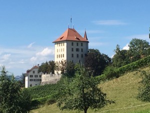
With legs still a bit achy from the hard walk in Ticino, but keen to get out and enjoy a beautiful summers day, Jules and I arranged to meet Diana & Louis in Hitzkirch to try a circular walk taking in some of the local villages.
We started with a relaxing coffee and gipfeli in Hitzkirch before heading off on the steady climb up to Müswangen enjoying the lovely views back over canton Lucerne, and south to the Alps. We stopped for a very good lunch in Alpwirtschaft Horben, - obviously very popular - the restaurant was very full and the customers were enjoying a local band playing. After lunch we continuned on enjoying the views over the Rigi, Pilatus and Titlis on the steady descent to Schloss Heidegg. We stopped briefly at the schloss for a coffee and a slice of Diana's cake before dropping back into Hitzkirch. It was a very pleasant stretch of the legs, although it was quite warm in the sun. This would probably make for a good winter walk on a clear, crisp day.
All in all the 13.5km took us 2 hours 50 on easy to follow paths with no challenges. The GPX plot of our route is here.
Walking Kappel Albishorn - August
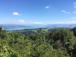
For a bit of a stretch of the legs between our two holidays, we headed over to Kappel to try a circular walk via Albishorn from the new favourite book - Rund um den Zurichsee.
The weather was glorious, and we headed off from Kappel in bright sunshine. The route was fairly easy to follow (minus the detours orchestrated by the navigator), and afforded excellent views over the Rigi on the way up, and then over the Zurisee from the Albishorn. We stopped for lunch at the bergrestaurant Albishorn, where the service was considerably better than the last time we'd been there.
After lunch we followed the route back to Kappel, where we stopped for a cup of tea in the monestary cafe - lovely views over the rolling hills south-west.
Overall the 12.8km took us 2 hours 40 of walking, plus the extra time for lunch and breaks. The GPX plot of our route (which deviates slightly from the book) is here.
Walking Mythen - July
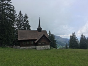
With a bit of a marginal day forecast, but keen to take my parents to the mountains, we headed to Alpthal to take a short wander around the base of the Grosser Mythen and surroundings.
The day wasn't excellent for views (a pity, since the panorama walk is spectacular on a good day), but we walked round the mountain to get to the small restaurant on the way to Zwueschet Mythen for a cup of poor coffee and a forgotten order of Speck mit Brot. Not wishing to hang around, we headed back past Holzegg to Alpwirtschaft Zwaecken for a lovely lunch and a alcohofrei Moest. Suitably refreshed we headed back to Holzegg and forsook the gondola for the walk back down the hill.
We finished off the day with a coffee and a brief tour of Einsiedeln including the monastery and grounds before heading back to town. All in all a very pleasant day out, and a fairly stereotypical "Swiss Sunday".
Walking Flumserberg - July
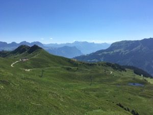
With a glorious day forecast, Jules wanted to take the opportunity to do a walk that she's been keen on for ages - a panoramic walk around three peaks near Flumserberg.
The route starts from the top of the Maschgenkamm gondola and loops around the large bowl, framed by Hoch Camatsch, Magerrain, Spitzmeilen and the Lauiboden valley. We parked in Oberterzen and took two gondolas up to the start, arriving about 11am (about the latest you can start this walk). From there followed the route without too much trouble - Jules doing an excellent job as navigatizonesmeister. I found the route quite hard work, either the altitude or perhaps a slight cold, or maybe the fact that we were trying to keep moving steadily to ensure that we made the last gondola down. Anyway, it was a non-trival day for me (although Jules didn't seem to have much trouble). We made good progress, stopping briefly at the top of Saechsmoor and Hoch Camatsch to catch our breath. We decided that we were making good enough time to do the whole route, and so did the extra loop around the Madseeli before dropping down to the Spitzmeilenhuette for a late lunch. From there it was a fairly brisk walk back to Maschgenkamm on good paths. We arrived in plenty of time for the last gondola (about 30 minutes to spare), but wouldn't have liked it to be much tighter.
The route certainly delivers the panorama that it promises. The visibility was good for us, and you can
see south to the Alps proper, and east to Santis, and the surrounding mountains are spectacular. The
scenery is classic Swiss - green alpine meadows framed by peaks which still held the last traces of
winter snow. All in all it's a lovely and impressive walk.
Overall the 17.5km with 1000m ascent/descent took us about 6 hours (including stops for breaks and lunch) and I'd rate it T2, but harder work than the statistics would suggest. The GPX plot of our route is here.
Walking Bauma - June
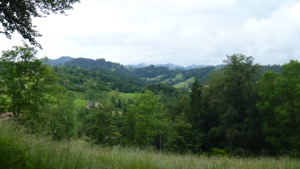
With yet another rainy Sunday forecast, Jules and I decided that a walk would be more appropriate than a cycle ride, and we headed off to try walk from the Rother book Rund um den Zurichsee - #15 Bauma circular.
The route turned out to be a good one – starting in Bauma - where there was a steam train demonstration going on – and climbing to a local ruin at Landenberg, before winding through pretty hills, villages and waterfalls for the remainder of the route. Navigation was easy – following the typically well-marked paths from village to village. We stopped in Sternenberg for a quick refreshment – yours truly breaking his golden rule, having a stange and then regretting it later – before heading on to the cave at Hagheerenloch and finally looping back to Bauma along the river Toess. We had glimpses of the potential views when the cloud lifted, and we must come back to do this route in better weather – it should be spectacular, in summer as well as winter.
Overall the 14.4km with 580m ascent/descent took us 3 hours, not including the break in Sternenberg. The GPS plot of our route is here.
Walking Bubikon - June
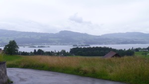
With very tired legs from the long cycle ride the previous day (but with lots of enthusiasm from Jules) we set off to try a more gentle walk from the Rother book "Rund um den Zurichsee", #12 Bubikon Circular.
The weather really wasn't on our side, which was a bit of a pity because the walk would have had spectacular views over the Zurisee and Albis ridge. We stopped for lunch in the cafe in the church in Gruningen, which was very pleasant before continuing on round the route.
Overall the 17.5km took us a shade under 4 hours of walking, plus the break in Grunigen for lunch and a coffee. The walk had about 400m ascent/descent, and was pretty flat overall. Would happily go back in better weather.
WalkingHeidiland - May
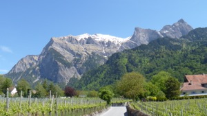
With a lovely day forecast and keen to get out for a walk, Jules and I headed to Maienfeld to try another route from the COOP book of walks, a variation on the "HeidiWeg".
The route starts from the centre of Maienfeld and, after passing through the very pretty centre, climbs steadily up on roads and then tracks to the Heidi Hut, nestled in the base of very steep slopes up to the local peaks. The route up is well marked and decorated with items and themes from the Heidi story. It'd be a lovely day out with children, and one we must remember for visitors, although the walk is non-trivial for little legs. Arriving at the Heidi hut we stopped for a perfectly pleasant cervlat and kase teller to recuperate before heading over the adjacent ridge and dropping down to Jenins. We stopped in town in the very pleasant Alter Torkel Weinstube for some minor refreshment before heading back to Maienfeld.
Overall the 14.2km and 730m VG/L took us slightly over 3 hrs, not including breaks and lunch and it's a T1. The GPX plot of our route is here.
Walking Rapperwil to Schmerikon - April
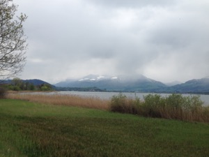
With a mostly grey and wet day forecast, but keen to get out and stretch our legs, Jules and I headed to Rapperswil to walk along the south-western section of the Zurisee.
The weather was as forecast - pretty grey, with occassional showers - but wrapped up well we decided to head out along the lake to try to get as far as Schmerikon. The distance was about right - in better weather (and with an earlier start) we might have considered doing the whole loop back to Rapperswil, but the section over to Schmerikon was a good choice. We were particuarly pleased to arrive in Schmerikon just in time to catch the boat back to Rapperswil which made a pleasant bonus for the day.
The route is very easy to follow, on well made up tracks with no navigational challenges. Overall the route is a T1, and the virtually flat 11.1km took us a shade over 2 hours. The GPX plot of the route is here.
Walking Limmat - April
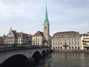
With a lovely spring day forecast, and not wanting to
travel too far, Jules and I set off from the centre of Zurich (Bellevue) to walk along the Limmat for a
bit of an explore.
Following the river downstream made for trivial navigation, and and we set off without a real plan or goal in mind, confident that we could get back to town pretty easily and quickly. The Limmat winds its way north-west out of Zurich, heading through different parts of town whilst gradually transitioning to countryside.
We made it as far as Schlieren before we decided that it was lunch time - unfortunately that part of Zurich is not the most pretty or well served, but we did manage to get an acceptable pizza just before the kitchen closed in Pizzeria Corona.
I don't think we'd do the walk again - the city parts are interesting, but past Werdinsel island the route follows the motorway through fairly suburban and commercial areas, and there are many more pretty places to go nearby. However, nice to get out and stretch our legs, and good to explore a part of the city that we'd never been to before. All in all we were walking for a bit less than 3 hours, and covered 13km in that time (including a stop for a good coffee at Primitivo near Flussbad Oberer Letten. The GPX plot of our route is here.
Walking Kussnacht to Luzern - March
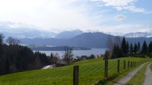
Many thanks to Diane and Luis for finding the only sun in Switzerland on Easter Sunday and organising a walk from Kussnacht to Luzern.
The chosen route was stage 3 of the long distance walk #98 Waldstätterweg, which starts at Kussnacht station and winds up the hill along the side of the lake before dropping down to Meggen and then along the shorefront round to Luzern. The views were good even in the slightly marginal weather, and would be fantastic in good visibility. The route should also be pretty good on a hot day (plenty of the route has some cover) and in spring when the flowers are in bloom.
Overall we were pretty pleased with the route, and would happily do it again. It took us about 4 hrs 30 for the whole 17.5km, on well signed paths. The route's a T1 and the GPX plot of our route is here.
Walking Albishorn - March
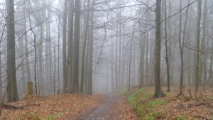
Completely ignoring the forecast and instead looking out the window, yours truly managed to persuade Jules to head out for a walk on Easter Friday.
The chosen route was #2 from Zuerich Hausberg: Albishorn, Buerglen, Hochwacht. The day started badly, with us taking the train to the wrong place (Sihlbrugg, rather than Sihlbrugg alter stadt) which meant that we didn't start until nearly 2pm in the afternoon. By that point the cloud had dropped below the level of the peak and it had started raining. Lovely. Turns out the inside of one cloud looks almost exactly the same as the inside of every other cloud. Grey.
We did struggle on through the whole route, with Jules even braving the difficult descent off the top of Hochwacht. However, it's a bit hard to rate the route since the views that one would normally enjoy weren't available. Overall the 12.8km took us about 3 hrs 30, all in, including 570m ascent/descent. It's rated as a T2+ which is perhaps a little harder than it actually is. The GPX plot for our route is here.
Winter Walking Flumserberg - March
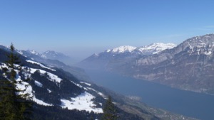
For the second part of George & Susie's Alpine experience, we headed to Flumserberg to do a winter walk from wanderungen.ch.
This turned out to be a very pleasant route leaving from Tannenbodenalp and heading up to the hotel
Seebenalp on the edge of a frozen lake. The weather was glorious again, with blue skies and enough snow
to be pretty, but the route was well prepared and we didn't need snowshoes. The restaurant at Seebenalp
was a pleasant surprise - very friendly and good food, we managed to upsell ourselves to a Kirsch and an
apple pie to finish a meal of schnitzel and pork chop fitness tellers. After the walk we stopped for a
quick apres at the funky plastic dome bar at Tannenbodenalp.
Overall the route was easy to follow, well marked and well prepared. The 9.2km (including a circuit of the lake to help lunch go down) with 370m ascent/descent took us 3 hours, at a fairly gentle pace. WT1, and the GPX plot of our route is here.
Snowshoeing Brunni - March
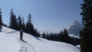
With the hope of a pleasant weekend in the mountains, George and Susie headed over to Zurich to visit us.
The weather was forecast to be excellent, so to take maximum advantage of the sunny weather we headed over to Brunni to do the circular route aroundthe Furggelenhuette hut, round Furgelenstock, to Holzegg. The weather didn't disappoint and we walked all day in sunshine, with some reasonably fresh snow underfoot. We stopped for a soup at the SAC hut, and then again for a more substantial lunch at Alpwirtschaft Zwäcken, both of which were very pleasant. At Holzegg tghe girls decided to take the gondola down, whilst George and I finished the day on foot.
The route is turning into one or our favourites - easy navigation, a bit of variety in teh scenery and lovely views in the sunshine. It's just about a WT2, 9.7km long and 610m ascent/descent and it took us about 4 hrs 30 all in, going at a fairly gentle pace and including lunch and breaks.The GPX plot of our route is here.
Snowshoeing Klewenalp - March
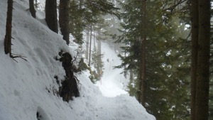
To make the most of the recent snows and good weather, Louis, Diana, Jules & I headed over to Klewenalp, above Beckenreid to attempt a kind-of circular route round from the top of the Klewenalp gondola, round to Stockhuette and down the Emmetten.
The plan didn't survive first contact with reality, as we realised that there wouldn't be enough snow to walk all the way down to Emmetten, so we elected to do an out-and-back route to Stockhuette instead. We set off in thick cloud, and after a bit of confusion on the ski-pistes we round the main route and dropped out of the fug. From that point the route was fairly easy to follow and well signed, at first along a well marked snow-shoe track and then down a toboggan run to Stockhuette. Amusement along the way was provided by the many off-piste opportunities and general short-cutting some of the switchbacks, with yours truly and Louis making the most of the opportunities. We had lunch in the restaurant at Stockhuette before heading back on the trail.
All in all the route is a good one, and if the cloud base had been a few hundred feet higher then we would have had lovely views over the lake. It's probably a WT2, albeit a fairly easy one, and the navigation would have been easy without the cloud (as it was the GPS was used quite extensively for a few hundred metres). Overall the route took us about 4 hrs 30 all in, for the 8km with 910m ascent/descent.
Snowshoeing Brunni - March
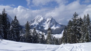
With a bit of a mixed day forecast, Jules and I decided to head to Einsieldn/Brunni for a day of snowshoeing.
We were delighted to be greeted by blue skies and bright sunshine, and we headed off up-hill through pretty snow covered pines follow the route up to Furggelenhuette hut. The hut was typically well frequented, and fortified with a bowl of soup we headed off round to Holzegg. We missed off the peak of Fuerggelenstock, as the final part of the ascent is a bit tricky, but had a very pleasant route round the ridge, basically following the contours through the skiing resort. We stopped for a bite to eat at the restaurant at the top of the Holzegg gondola before dropping down back to Brunni.
Overall the route was about 9.6km, with 610m ascent/descent and we took a bit over four hours all in. The route is technically a WT2, but not particularly challenging. Most of the vertical ascent is in the first hour, the route around is mostly flat and the descent to Brunni is steady and not too steep.
Snowshoeing Amden - February
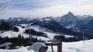
With a superb day forecast (sunny, with good visibility), Jules, Andreas and I headed back to Amden to do the shorter version of the Fallen trail that Jules and I had scoped out a couple of weekends previously.
The outing started off a bit short of snow, but this quickly changed as we climbed up out of Amden. We were grateful to have done the route before as we headed off on the right trail this time and had no problems at all following the correct path up. We elected to have lunch at the Walau restaurant, at the top of the Mattstock chair, which was very pleasant indeed...
Overall the 3.7km took us 1 hr 30 at a leasurely pace, and the route is a simple WT1. The GPX plot of our route is here
Snowshoeing Amden - January
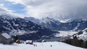
With the recent snowfall stabilizing and reasonable weather forecast, Jules and I decided to head over to Amden to check out the Fallen trail as a warm-up for a possible trip later on in the season.
The chosen route wasn't very well marked at the start (a slight surprise to us) and with only the panoramic resort map to go on we didn't stay on the path very long, and instead took a detour up a different mountain. Realising our mistake quite quickly (with the assistance of a helpful local) we found our way back onto the proper route, and noted the signage that we'd previously been missing. Once safely on the right mountain the route was fairly easy to follow, winding up through fairly pretty countryside to reach the Baerenfall draglift. We stopped at the Aelplibar for a very acceptable lunch of wurst and soup in the sun. After lunch we headed off on the winter wanderweg to the Hinter Hoehi, before doubling back to the Mattstock chair for download back to Amden.
Overall the route was 7.4km (including detour) with 670m/290m vertical gain/loss. It took us 1hr 55 not including breaks or lunch, in fairly easy snow conditions. Overall we'd rate it as WT1 with no technical or intimidating parts. The GPX plot of our route is here.
Walking Frick - January
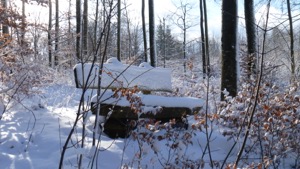
With winter having finally arrived we were keen to enjoy the snow and opted for a walk near Aarau due to it being the only region that promised some sunny spells (plus we weren't too excited about having to try our avalanche rescue kit in a ski resort!). After a drive on icy roads and with poor visibility we arrived in Frick for our 15k circular walk. Starting out from Frick with a steady climb we had anything but sunny spells, and the temperature (forecast around 0 degrees) felt more like -4 in what turned out to be a rather unpleasant snow storm. Thanks to Stu carrying two hats Jules did not end up with frozen earlobes...
However, having pushed on we were rewarded with great views over the valley and a lovely path through a wintery forest once the sun eventually came out. True to himself Stu had picked a walk with a bit of a hill, which we had conquered about 2/3rds into the walk. Navigation was easy, with lots of well sign posted paths. With Jules getting hungry after the first 30 minutes and talking about Roesti for the remaining 2 hours we arrived at the “Krone” in Wittnau for our lunch stop. Despite the decor of the “Krone” clearly being stuck in the 80s we enjoyed a good meal, and were relieved to have a further hour left of the walk to digest the enormous portions.
We returned to Frick within about 3.5 hrs (without breaks) and finished our walk with a tea in the local cafe (unbelievable - open at 17.00 on a Sunday!). There was a little more excitement on the drive back with the Q5 opting for ABS to make sure we got safely around a frozen roundabout. All in all a good day out!