Walking Bauma - December
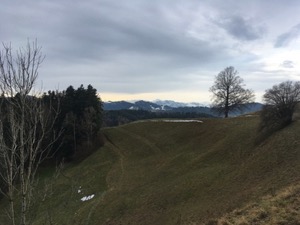
With poor weather forecast in the mountains - strong winds and too warm for skiing Jules, Michael, & I headed over to Bauma to do #15 from the favourite Rother book Rund um den Zurichsee - Bauma circular.
The weather was lovely as we set off but clouded over a little during the day. However it stayed dry and warm and we had some glimpses of the views across the Alps and all the way to the Juras, albeit under low grey clouds by the late afternoon.
The route starts with a good warmer-upperer, then after a brief respite climbs steadily to the ridge which it then follows in an arc before dropping down to the Töss. We made steady progress, stopping for a thermos of tea at about the half way point once we realised the the restaurant at Sternenberg was closed on Mondays (it was also closed for refurbishment as it turns out).
Overall it was 14.4km with 520m ascent/descent and it's a T1, albeit with some steps and some steeper sections. It took us about 3 hours, excluding the break, and the gpx plot of our route is here.
Skiing Andermatt - December
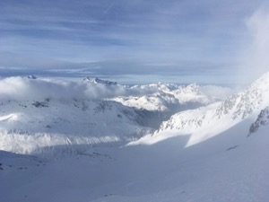
For the first day of the 19/20 ski season, I packed my powder skis in the car and headed over to Andermatt where there had been lots of snow at the top, and good weather forecast throughout the day.
I wasn't the only person who'd read the forecasts, and the resort was pretty popular as one might expect. After a bit of faff buying tickets and queuing for the lift I finally made it up the moutain and headed off. It took me a few runs to get the feel of it back - I was quite rusty after the summer break, and the powder skis are a little harder work carving than my piste skis. However I managed to get into an ok rhythm by the end of the day although my off-piste technique was still very lacking!
I managed to cover most of the Gemsstock side of the hill, only declining the skiroutes (not up for those by myself at that point), and had good fun on the middle section of the mountain and a couple of good runs down from the top. The best snow of the day was the lovely carving runs down from the t-bar.
Overall I managed 33.4km with 6970m of descent over 19 runs. A good first day for the season.
Walking Meilen to Forch - December
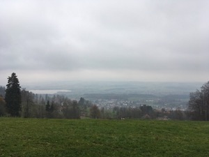
With the weather not so great - low cloud and a bit cold, Michael and I decided not to tackle a big hill, and instead headed over to Meilen to walk up the Pfannensteil to Forch vai Hochwacht
The route climbs pretty steadily out of Meilen, with good views over the Zurisee, albeit under a bit of a grey sky. Unfortunately the cloud base was just below the peak of the hill, and somewhat detracted from the normally great views from the top. We headed into Hochwacht for a coffee and a kirsch to warm up a bit, and then headed off through the woods to Forch.
The 9.7km with 460m ascent / 260m deceent took us about 2 hours, and it's a T1. The gpx plot of our route is here.
Walking Kronberg - November
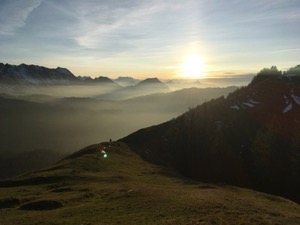
Continuing the theme of more challenge walks, Michael and I headed to Kronberg to walk up the hill from Jakobsbad.
The weather had been forecast a bit marginal, but the webcam on showed only high wispy clouds, so we decided to give it a go. We arrived a little later than ideal, but didn't hang about and headed straight up the hill.
The route climbs fairly steeply out of the valley from the Kloster - bit of a slog to get to Lauftegg, but then flatter until Herrendürren before the final major climb up to the ridge above Hölzli. From there it was a bit of up and down along the ridge to loop round to Kronberg, with just the final insult-to-injury climb to the lift station. We made it in plenty of time for the last lift down (in fact we caught the one before that).
We were treated to fantastic views all the way up, with the fog creeping up the valleys and the Alps in full glory stretching east and west from Säntis. A really lovely walk and the best we could have made of the day. Overall it was 9.1km and took us 2hrs 30 for the 930m/170m ascent/descent. The gpx plot of our route is here.
Walking Etzel - November
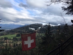
Up for a bit more of a challenge, Michael and I headed over to the Schwyz side of the lake for a walk up Etzel.
The chosen route was part of route #4 from the Zuercher Hausberger book, but looping back down to Pfaeffikon rather than continuing on to Sihlbrugg. We headed up the hill at a steady pace, before yours truly remembered that the hard tree section is at the end of the climb, not the beginning!
We'd walked into the snow-line by the time we reached the berg restaurant at the top. From there we were treated with good views across Sihlsee and Einsiedeln, but unfortunately with clouds obscuring the high alps.
After a brief stop for refreshment we continued the loop back down to the train at Pfaeffikon to finish the walk. Overall it was 10.5km, with 680m ascent/descent and took us about 2 hours 35 walking time, not including the breaks. The gpx plot of our route is here.
Walking Stäfa to Rapperswil - November
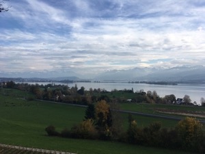
For a slightly easier walk, Michael and I headed to Stäfa to do the complete walk #19 from Rund um den Zurisee from Rother
The weather was better than forecast and we headed off in bright sunshine which lasted for most of the walk, just clouding over a little by the time we arrived in Rapperswil.
As always this route has lovely views if conditions are right and we were treated to the snow-capped mountains in the distance framing the Zurisee and Rapperswil castle.
Having done parts of this route a few times recently there was no issue with the navigation and we made fairly quick time on the route. We arrived in Rapperswil in about 2 hours (not including a brief stop in Feldbach) having covered 11.2km with about 200m ascent/descent. The gpx plot of our route is here.
Walking Uetliberg Ridge (Felsenegg to Triemli) - November
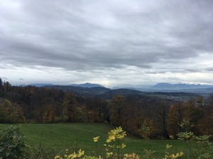
With a bit of a mixed weather forecast, Michael and I decided to try to squeeze in a walk from Felsenegg to Uetliberg.
It was quite a grey day, with a cold stiff breeze on the ridge, but it stayed dry while were were out. We made good speed to Uetliberg, and decided to risk carrying on down to Triemli rather than to take the train down.
Overall it was 8.4km and about 150m/550m ascent/descent and took us 1 hr 40, not including a brief stop at Uetliberg. The gpx plot of our route is here.
Walking Albis pass to Zug - October
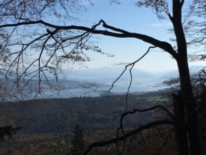
With a lovely late summer day forecast we headed out to the Albispass to do the second stage of Swiss regional route #47, to Zug.
There's a bit of up and down along the Albis ridge (with some grumbling about this supposed to be a downhill walk), then dropping down the other side of the ridge at Oberalbis. The route then winds through woodlands and alongside streams into Zug. The walk has lovely views for most of the length. These begin with the Zurisee at the start of the walk, and then the Zuggersee and the Rigi & Pilatus for the second half.
We stopped for a picnic lunch just before Oberalbis, and then just outside Zug for a lovely espresso courtesy of Diana's hand-pump espresso kit.
Overall it was a little over 18km and took us 3 hours 40 including 350m/700m ascent/descent. The gpx plot of our route is here.
Walking Uerikon to Rapperswil - October
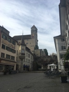
With a surprisingly good day October day ahead of us and to make the most of the weather, we decided to head down to Uerikon to do the walk to Rapperswil with my parents.
We chose the same arrangements as earlier in the year and drove to Uerikon station where we left the car and continued on foot.
Once again, this walk didn't disappoint and we were treated to lovely views over the Zurisee and down towards Rapperswil. We made steady progress despite it being a little muddy underfoot with the recent rain. We stopped in Feldbach for a brief rest before deciding to head on the rest of the way to Rapperswil.
We arrived with the sky clouding over a bit, having walked through the best part of the day, and stopped at the Kaffee Klatsch in the square for a warm drink before getting on the train back to Uerikon.
Once again a good gentle walk, with lovely views and pretty sights to finish. 8.2km, almost flat (T1) and about 2 hours not including breaks.
Walking Einsiedeln Spital - October
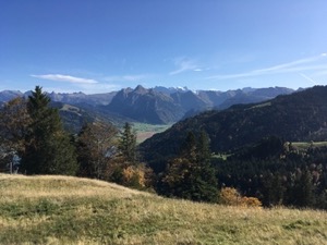
With a lovely autumn day forecast and keen to get out for a decent walk, Jules and I headed off to Einsiedeln to do walk #33 from the Rother book Rund um den Zurisee - Rund um Einsiedeln.
We were abandoned by our friends, but set out bravely from the Kloster Einsiedeln, following the route over to Gross, then up Himmel and on to Spital before looping back via Obergross and to Einsiedeln. We were treated to stunning views of the alps, clear from Pilatus to Säntis and south into the Alps proper. The trees were in their autumn colours, although probably at their full glory in about a week's time. We particularly enjoyed the very pretty paths through the high moorland at the top of Himmel, where Jules even found a late blueberry or two. This would probably be a great walk in summer too, as the main and steep part of the ascent is in the shade through the woods.
We found the walk a bit tougher than expected - probably because we did the main ascent a bit quickly, but also because the descent is quite steep. We were both feeling our legs by the time we got to the end of the 17km and 1000m ascent/descent. It was about 5 hours 10 including breaks and sandwiches, which was probably a bit quick. The gpx plot of our route is here.
Walking Dreiländerstein - September
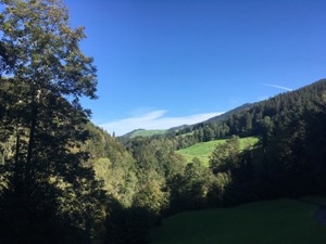
With a lovely day forecast, Jules and I headed out to try route #44 from Rund um den Zurisee. The bright sunny day and the excellent visibility made for great views of the mountains both near and far.
The day started with a slight navigational error - yours truly accidentally driving to the wrong start halfway up the hill in Finstersee, rather than Finsterseebrugg, but we struggled it off and headed on our way.
The route climbs steadily up to Bellevue, with lovely views out over the Zurisee and surrounding hills. We then headed along the ridge before dropping down to a late lunch of a rather good Goulash and Gersten soup in the sunshine at Rossberg. Suitably refreshed we carried along the route, which drops down to and then along the Sihl to FinsterseeBrugg (the official start of the walk). The last bit of ascent wasn't too tricky to get back to the car, although we were starting to feel our legs a tiny bit by that point.
Overall it was 3 hrs 45 minutes of walking for 16.2km and 690m ascent/descent, and we'd rate it a lovely T1+. The gpx plot of our route is here.
Walking Dietikon to Baden - September
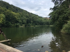
With a slightly grey day forecast, but the possibility of some sunny spells, Luis, Jules and I headed to Dietikon to do the panorama walk to Baden.
We have done this walk before, back in 2015, and we followed roughly the same route as last time. The path heads fairly promptly out of Dietikon before climbing steadily up to the Agelsee and then along the ridge before dropping down into Baden town. There are lovely views en-route, and the majority of the walking is in the countryside, which is very pleasant.
The weather was fairly kind to us - it didn't rain, but there were fewer sunny spells than we'd hoped. We stopped for a brief snack at about the halfway point, and then for a coffee at the Rüsler restaurant which is about 2/3rds of the way. We were quite ready for the a drink in the pub when we arrived in Baden, and headed to Mr. Pickwick's to sample some British beers, and to round off a nice walk
Overall it's about 17km, and took us 3hrs 30 plus breaks with the 440m ascent/descent. The gpx plot of our route is here.
Swimming Rhein Basel - August
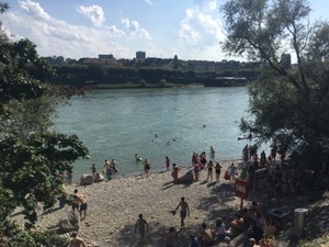
With the warm summer weather starting to get a bit more uncertain, Rory and I headed up to Basel to go for a swim in the Rhein
We took the train to Basel and made our way slowly to the entrance at the Solitude park in Basel Tinguely. The river was flowing faster than I expected, and in particular became quite a lot stronger away from the shore. However, it was all good fun and perfectly safe, and we certainly weren't alone in the river.
It took us about 30 minutes to drift to the final exit point at Dreirosenbrücke, and after a quick shower headed for a beer in the sunshine on the bank of the river. Overall it was good fun, a slightly long way to go for a swim, but worth it for the experience.
Walking Uerikon to Rapperswil - August
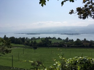
With the early morning fog promising to burn off, Jules and I headed to Uerikon with Andreas and Inge to do a part of walk 19 from the Rother book Rund um den Zürisee.
We decided to drive down to Uerikon, which made sense with four of us travelling, and and started off from the train station. The navigation was very easy with the paths following the contours of the hills along the lakes. We were treated to lovely views towards Rapperswil castle and the mountains to the south through the gaps in the trees.
We made slow and steady progress and arrived in Rapperswil in time for a mid-afternoon coffee and cake. in the main square just below the castle
As luck would have it, we were in perfect time to take the boat back to Uerikon, which was an excellent choice in the beautiful sunshine, and made Jules very happy.
Overall it was 8.2km, and mostly flat. The gpx plot of our route is here, and we'd rate it an easy T1.
Walking Kussnacht to Lucern - August
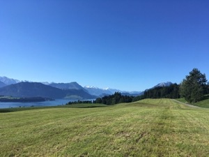
With a stunning summer's day forecast, we arranged to meet up with Janine, and to head out for a gentle walk from Küssnacht to Lucerne
We met at the station, and headed off in bright sunshine, under blue skies. We were treated with excellent views, including the Rigi and even as far at the Eiger / Matterhorn group. The route was very easy to follow and our only regret was not taking our swimming costumes - we were slightly envious of all the people enjoying a swim in the lake.
We made gentle progress enjoying the day. We stopped for a cake and a coffee at Schloss Meggenhorn. Afterwards, Jules and I headed on to Lucerne to round off a lovely day
Overall the 17km took us about 4 hours, not including breaks. The gpx plot of our route is here.
Walking Wildspitz - August
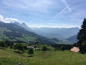
With lovely weather forecast for Swiss National day, Jules and I decided to head over to Sattel to walk up the Wildsptiz.
We parked in Sattel and after saying hello to the neighbours (who had had a similar idea) we headed off. It was perfect conditions for a walk - bright and sunny but not too hot, with good views over the Alps to the south, and the surrounding peaks. The path climbed steadily through pretty woods and classic farms and grazing land, including a fairly large herd of llamas who were pretty nonplussed to see us (although this could well be the natural state of a llama).
Being Swiss National Day, people were out in force, including one old timer making a determined ascent of the Wildspitz - full respect, and I certainly hope that I'm still climbing mountains when I'm his age.
We stopped for a light lunch at the peak, and then looped back down via a slightly different route, to make a bit of a change.
We finished off the day by buying some rather good landjaegers in the Hofladen at Sattel, including some made of llama meat (which Jules refused to eat).
Overall the route was 13.6km with 900m ascent/descent and took us 3hrs 40. I reckon it's a T2- (quite steep up in some places), and the gpx plot of our route is here.
Walking Grünigen - June
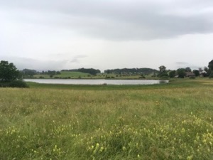
Hoping to catch a break in the weather, Jules and I headed to Grünigen to try a circular route from www.bergfex.ch "Rund um den Lützelsee" / Round the Lützelsee.
The weather wasn't very kind to us - it was drizzling when we arrived, but we decided to head out anyway.
We made fairly good going for the first half of the walk, and it was nice to stretch the legs and see a slightly different part of canton Zurich, but unfortunately the rain turned quite heavy at exactly the furthest point, and we got kind of wet.
We did see some very interesting flowers, including Yellow and Siberian Irises and a European Yellow Rattle (according to Flora Incorgnita), and naturally we saw the Storks at Haselstrasse. We also picked up some rather good cheese from the Hofladen at Lutikon
Not really being bothered to put on full waterproofs we were thoroughly wet by the time we finished, we even had to turn on the heated seats to warm up on the drive home. Overall the 9.7km, basically flat took us 1 hr 45 and the gpx plot of our route is here.
Walking Buergenstock - May
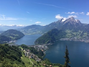
With the first really good day of summer forecast, we headed off with Diana & Luis for a summer walk. The chosen route was Stansstad via Bürgenstock to Buochs, number #15 from Rother Wanderbuch / Rund um Zürich.
After a brief struggle to park in Stansstad we headed off, following the lake for the first section of the walk. The route then climbs fairly steeply with lovely views across to Pilatus and over the lakes, and on the other side of the hill, snow capped Alps to the south.
We stopped for a brief rest at the top and a cup of tea. Diana showed us her discovery of the Flora Incorgnita app which looked to be very good, and succeeded in identifying a early summer orchid growing close to where we'd stopped.
We lunched at the slightly overpriced 1879 Taverne at Bürgenstock, but enjoyed the lovely views. Refreshed we headed on down to Buochs, stopping at the lake for a brief drink. Jules was talked into trying the official drink of Nirweiden, but wasn't particularly taken with it!
Overall the walk was 14km, with 800m ascent/descent and took us 3 hrs 40 minutes plus the breaks and lunch. It was definitely a T2, and a fairly strenuous climb for the first proper walk of the summer. The gpx plot of our route is here.
Walking VorderRhein - May
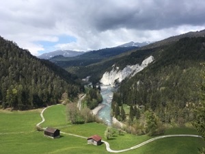
Finding myself in Versam Safien I decided to head up the Vorder-Rhein, along the Rhein gorge, starting in Versam and ending up in Ilanz.
The route is pretty spectacular - very shear sided cliffs on both sides of the river carved out, leading into wider meadows further up the valley. The walk itself is every easy and safe, following the river and the railway line along the base of the valley, climbing gently overall, but not rally getting much more than 50m above the level of the valley floor.
I took the train back from Ilanz, which was quick and easy, although a bit confusing to catch - I even got whistled at by the driver of the train going the other way who wasn't happy with where I was standing, or my crossing the track.
The 9.2km took me a little under 2hrs at a gentle pace, with no navigational challenges at all. It's a T1, and pretty good value for money.
The gpx plot of my route is here.
Walking Bülach Stadelberg Circular - April
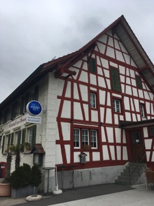
With a fairly reasonable day forecast in Zurich, but low-ish cloud and the possibility of a rain shower putting us off a trip to the mountains, Jules and I headed to Buelach to try route #5 from Rund um den Zurisee by Rother.
We had the usual fuss leaving Bülach station - for some reason I always get confused about how to get out of the place - but found the right way after a few minutes and headed off. The route starts out along the Glatt before heading inland and starting to climb into the hills. We made good progress to Stadel where we stopped for lunch at the Restaurant Brauerai for the largest cordon-bleu I've ever had, but not the largest ever - that world record being held by the chef, but not available on the Sunday lunch menu (thank goodness).
Slightly stuffed we headed off up the hill to the highest point on the walk - the Stadelberg lookout. From there it was a fairly long, gentle loop back to Bülach, with some nice views over the rolling countryside and fields. We were treated to lots of birds on the walk, including some seen and some only heard - particularly in the woods.
Overall we clocked it as 21.3km, and it took us about 4hrs 15 of walking, plus the stop for lunch and a quick break in the afternoon. It's a T1+, owing to some steps and the climb up the Stadelberg. The gpx plot of our route is here.
Work Skiing Trip - March
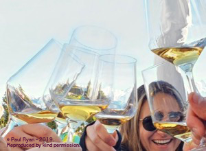
Many thanks to Jay for being the prime organiser of our work skiing trip. We had a great time over the weekend, helped by fantastic weather and better company. The days broke down as follows;
Friday
Some of us woke up on Friday feeling slightly worse for wear - possibly as a result of one too many Amber beers in Rocky. We made slightly slow progress up the mountain - Paul nearly defeated by his ski-boot at one point - however, the first wave made it to the top in glorious sunshine to start a lovely days skiing.
We headed over to Satel, which was in lovely condition a bit higher up. From there we had a good cruise around for the morning on pretty quiet slopes. The snow was a bit crunchy first thing, and particularly lower down but it softened up as the sun got to work on it.
We met up with the second wave of skiers in Plaun and then headed over to Startgels for what turned out to be an excellent steak (although missing the polenta) and a long, lazy lunch. We finished with a run down to Flims where yours truly had to go for a lie down before heading out for a late dinner of pizza.
All in all it was a pretty relaxed and sociable day, with us covering 28.km and 4,600m of descent over 7 runs.
Saturday
Most of us woke up feeling a bit better for a slightly earlier night, and we headed up the mountain. After a warm up run or two around Nagens we headed over up to Satel to give those who hadn't skied it on Friday the chance to see that side of the mountain. The run wasn't in the best condition - a bit slushy and quite bumpy, and it was a bit hard work on slightly tired legs. We stopped in Ruschein for lunch (arriving just at the wrong time), and then settled in for a lazy afternoon sat in the sun and drinking schnapps. It's a hard life.
We finished with a lift up Lavadinas and a long run down to Plaun before lifting up to Nagens and finishing down Stretch. All in all we covered 34.2km with 5,600m of descent over 8 runs.
Sunday
For the final day, Paul and I decided to try to get a good morning of skiing in before we had to head off. We actually managed to cover a fair bit of the mountain, including a couple of runs under Tres Palais, which was in excellent condition, and a run down to Curnius to see the half pipe on the lift on the way back up. We finished with a run down Startgels to close a great weekend.
The stats for the final morning were 26.7km and 4,500m of descent over 10 runs
Skiing Flims - 3rd March
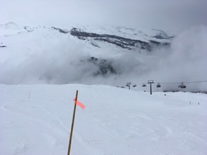
Trying to find some snow up high, but a bit concerned about the incoming storm, Michael & I headed to Flims for a bit of a cruise about, hoping to find a balance between winter and spring conditions.
We were pleasantly surprised when we arrived - the weather was better than forecast sunny and fairly clear skies. We made the most of the morning, and had a good ski around Nagens above Flims before heading to La Vacca for a good steak lunch.
Unfortunately the weather was much worse when we left the teepee. The storm had arrived and with it fairly low cloud and snow at Plaun. We did a somewhat disastrous run down to Falera, getting rained on at the bottom and skis barely moving in slushy snow. We retreated back up the mountain and to our surprise found some pretty good snow on Skiroute #73, which we did a couple of times, with better visibility and conditions each time. We downloaded from Plaun (the top of the mountain had closed owing to the wind), to finish a perfectly respectable day, with a couple of more technical and interesting runs than expected.
In total we covered 34km, with 6,000m of descent, over 12 runs
Skiing Flims - 2nd March
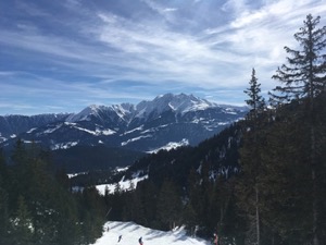
With a great day forecast, I headed down to Flims to go skiing with Jay, Izzy, Harry and the gang, with Jules joining later to do a little cross country.
We made an early start - only slightly delayed by the queues since we weren't the only ones enjoying the mountain that day. We started down Stretch, which was in beautiful condition at the top, at a cracking pace set by Harry. Then we headed over to hook up with the skiers above Crap Sogn Gion for a gentle run down to Cornious mostly together. Jay and I then headed off to do something a bit more challenging - #84 down to Falera. Conditions were pretty tough - a thin loose layer over refrozen lumps, turning to slush lower down, but this would be a brilliant run in fresh snow. A bit knackered, but safe and sound we headed back to Plaun to hook up with the others.
We did one last run down Stretch together, then I did one more run down startgels to finish skiing for the day. All told it was 39km, with 6,500m of descent over 11 runs, so a pretty respectable day.
Skiing Flumserberg - February
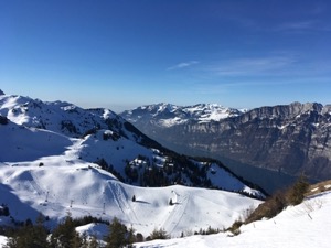
With a bright, sunny day forecast, but it having been a little while since the last snow, I decided to head to Flumserburg for a bit of a cruise around to see the mountain and explore.
The weather was as forecast, and I wasn't the only one with the idea of going out skiing. I parked at Tannenheim where the car park was almost full at 9:45, but there were no real delays and I was on a lift before 10am with no hassles.
I had a good cruise around the mountain in the morning, slowly making my way across to Seebenalp trying most of the runs and lifts. I quickly learned that the blacks are proper blacks in this resort - quite narrow and steep and icy.
I lunched in Hotel Seebenalp - with a very good (as usual) fitness teller, with the good views up the mountain. Suitably refreshed, I spent the afternoon cruising about slowly heading back to Tannenheim with the one notable event of a spectacular fall in front of a group of Swiss children (one even stopped to ask me if I was OK)!
By reputation this resort gets quite busy at the weekend, and I can understand that given the proximity to Zurich. However a lot of the area seems skiable in good conditions, in particular the run black #42 off the back, and the area under the Leist lift.
Overall I had a pretty good day - a total of 47.6km of skiing and 7,900m of descent over 28 runs.
Snowshoeing Raten - February
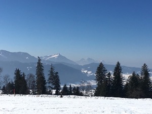
For a gentle warm-up on snowshoes, not having been so far this winter, Jules and I headed to Raten to try out a short loop.
The route was very picturesque with spectacular views across the alps, including the Rigi and Pilatus all the way to Saentis.
Conditions were perfect - lovely blue skies and warm in the sun. The route itself is pretty easy and would be perfect for guests or people who haven't done any snow-shoeing before. We finished with a light lunch at the restaurant at Raten - slightly embarrassing that we've been there before, but didn't remember!
In total it was a pretty relaxed day, with only 5.1km of easy (T1) snowshoeing and 150m ascent/descent which took us 1 hour 10 minutes.
Winter Walking Haemikon - February
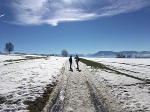
With good weather forecast, and keen to get out for a winter walk, Jules and I headed over to Haemikon in Lucerne to meet up with Diana and Luis.
We had done part of the route before in summer, but it was nice to see the countryside in different conditions. Once again we were treated to spectacular views across the alps, covered in snow and under bright blue skies.
We stopped for lunch at the slightly busy Alp Restaurant in Horben before looping back through the woods.
Unfortunately I had a bit of a nasty cold, and by the time we finished we were at about the limit of what I could enjoy that day. All in all it was 11.2km with 200m ascent/descent and a T1 with easy navigation that took us a bit less than 2 hours 30. The GPX plot of our route is here.
Skiing Flims - 27th January
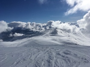
With a bright sunny day forecast after a bit of snow - Michael and I headed off to Flims for what turned out to be an awesome day.
Slightly delayed start owing to Michael deciding to rent some powder skis for the day - which was definitely the right choice, judging by the chuckles for most of the day.
We spent most of the day playing in powder off the sides of runs and skiroutes. Conditions were awesome - really confidence inspiring with plenty of deep snow but a solid base underneath. The only slight pity was yours truly being on slalom skis - definitely more effort in the deep stuff than the Salamon 106 QSTs!
We started with the traditional run down stretch to warm up, then headed up off up to Tres Palais to play on skiroute 85 (The recommended route #84 To Falera being closed, so we declined it) Before dropping off the back down black 41.
Lunch was a quick stop in the canteen at Vorab before heading off to try the fantastic powder off the side of black #26 from La Sciala - so good we had to do it twice! From there we headed over to skiroute # 83, then #72 before heading up and over Startgels to finish happy but exhausted. Probably in my top 3 days of skiing, despite taking the wrong skis!
We finished on a very respectable 44km, 8,200m descent given it was almost all technical, off-piste skiing - not a cruise all day!
Oh, and Michael bought the powder skis....
Skiing Flims - 20th January
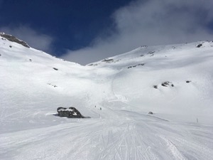
Under blue skies and with loads of fresh snow, Michael and I headed down to Flims for what turned out to be a cracking day's skiing. The entire mountain was open (even the Porsche lift and #35 Sattel), and plenty of sunshine in which to enjoy it.
Breaking with tradition, we headed straight off up the mountain, via Mutta Rodunda and Vorab to find black #35 Sattel. Conditions were great on that side of the mountain, and the pistes were in lovely nick. We came up the Porsche lift a few times doing the free-ride route #86 as well as #80.
It was a good day for cruising around and seeing the top of the mountain for the first time this season. We managed a good selection of the classic routes Flims routes in the morning and into early afternoon. We both reckoned that we were skiing a little better on this occasion - the slightly more technical off-piste routes forcing good balance and technique which paid off later in the day.
For lunch we stopped in Startgels for a really excellent steak and roast potatoes that was totally worth the stop. It's the first time I've been to that restaurant, and I see why it has the reputation that it does.
After lunch we skied until basically the end of the day, continuing the theme of cruising around and picking up odd routes where they looked good. We finished by catching Scansinas up to Mutta Rodunda to ski back down black #16 and then down Stretch to finish.
Overall we managed a pretty respectable 45km, with 7,600m descent over the day. We were only delayed a few times by Michael retrieving his skis and putting them back on (he claims the binding was set too loose for the powder, yours truly was sarcastic)...
Walking Kappel - Albishorn - January
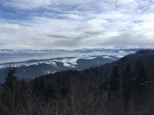
With a slightly grey day forecast, and not feeling up to a long snow-shoeing trip, we headed over to Kappel to do route #47 from Rund um den ZurichSee - Kappel Albishorn circular.
This turned out to be a good choice, and with slightly better visibility than expected, there were lovely views of the Rigi, the alps and the Zurisee . We followed the same route as last time in August-16 , without any challenges.
We stopped at the restaurant at Albishorn for a very good lunch, and the service once again friendly and attentive. We're starting to think that we just got unlucky the first time we went, as it's been pretty good the times we've been back Heading off along the Albis ridge - a bit slippery in places with the hardpacked snow, but we made it down without problems. All in all a good walk, and not to far to travel - a good option for the day.
Overall the 12.9 km with 450m of ascent/descent took us 2 hours 50, not including a break for a cup of tea and lunch. We'd rate it basically a T1, and the GPX plot of our route is here.
Skiing Flumserburg - January
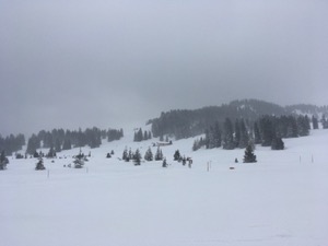
With a pretty rubbish day forecast, but the website suggesting that about half the mountain would be open - I headed over to Flumserberg to try to get a bit of skiing in.
I was pretty disappointed on arrival, with only three lifts open, and not connected, but I made the most of the day. There was some powder to be found under the Prodalp Express to the (skiers) left of route #3, which was a nice surprise. I was skiing pretty badly - no real excuse, except that the very poor visibility might have been affecting my balance. At this rate I might be turning into a fair weather skier!
Lunch was a perfectly forgettable pizza in Sonderbar at Tannenheim, but I couldn't be bothered to drive anywhere else, and most places were shut.
With the weather deteriorating after lunch I only managed a couple of runs before long queues at the lift and pretty bad visibility exhausted my enthusiasm. To my pleasant surprise, I did get a partial refund on the lift ticket, which was nice.
Overall I managed 9 runs, to a total of 18.3km, and 3,100 m of descent.
Skiing Flims - 6th January
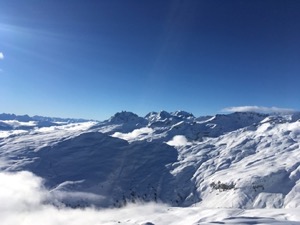
With the possibility of a good day forecast, clouds earlier on but clearing later, Michael and I headed to Flims to try to make the most of the early season snow.
We were lucky with the weather - clear blue skies higher up the mountain with just a layer of cloud about half way down. Unfortunately winds had closed the top of the mountain (where the weather was best), but we had a good day on what was open.
Great snow conditions really helped, and the free-ride routes were in excellent conditions. We did a few variations on route #85 under Très-Palais, and some good fun runs down black #16.
Overall it was a pretty respectable day despite being restricted in how much of the mountain we could ski. We covered 44km over the ground with 7,879m of descent.
Winter Walking Unteriberg - January
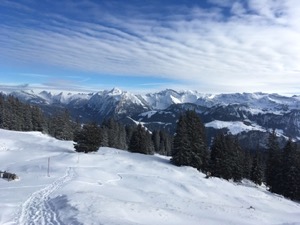
With a nice sunny day forecast in the mountains, Jules & I headed out to Unteriberg, near Hoch-ybrig to walk up Spital.
We decided to go for a walk rather than take snowshoes as the peak is fairly low and there hadn't been that much snow recently.
It was quite cold when we set off from Unteriberg - probably about -8, but we quickly warmed up on the climb. We made steady progress up to Spital, although we did turn off the intended path at one point, as it wasn't that clearly marked as a walking path, and there was a better track to follow. Arriving at the peak we declined to stay long, and instead found a bench to have some oakcakes and tea in a sheltered spot out of the wind and in the sun.
We had a slight problem at the top of Raegenegg, where the intended path down was closed for the winter season, but we [cough] made it down somehow [cough], and headed onto Hoechguetsch for a Gursten soup to warm up. From there it was a brief stroll back to Unteriberg to finish a lovely days walk with some beautiful views.
Overall the 12km with 730m ascent/descent took us 3hrs20, and it was just about a T2. The GPX plot of our route is here.
Walking Faellanden to Rigiblick - January
With a grey, wet day with low cloud forecast, Jules and I headed over to Faellanden to do a local walk to stretch our legs on New Year's Day.
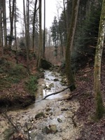
The weather was as forecast, but fairly well wrapped up we headed off up the hill from Faellanden towards Rigiblick. We made steady progress up the gorge, with large granite boulders lying beside the path. We made good progress to the ice skating rink, but couldn't be bothered to stand in the queue and pay to get in, just to have a cup of coffee. Instead we carried on towards the zoo, and stopped for a very pleasant coffee and cake in the Sorell Hotel Zürichberg before continuing on the Panoramaweg to the top of the Rigiblick funicular.
It was a decent stretch of the legs for New Years Day, and the 10.3km took us a little over 2 hours, not including the stop of a coffee. The GPX plot of our route is here.