Walking 7 Peaks Flumserberg - July
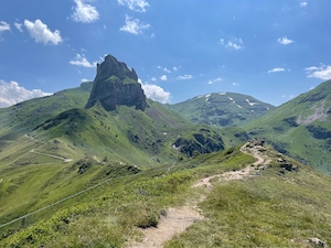
With a lovely Saturday forecast (but Sunday looking a bit rubbish), Jules and I switched our normal weekend around to go hiking in Flumserberg. The route we chose was the 7 peaks (sieben Gipfel) route, which starts at the top of the Maschgenkamm lift, then loops round and heads back down to Tannenboden, taking in - you guessed it - 7 peaks.
It was a fairly popular route on a bright and sunny day, even considering the holidays. The route is fairly tough (or maybe we’re out of shape), and starts with a series of climbs up to the highest point of Mütschüelergulmen - where Jules did very well on the slightly exposed bits. We’re pretty sure we saw a golden eagle on the way up, but only for a moment, and unfortunately not long enough to take a photo
We stopped for a packed lunch (Jules having done a superb job with the sausage rolls) below Mütschüelergulmen. From there we continued behind Sächsmoor, where we think we heard marmots shouting to each other but didn't see any. We took another short break between Kleiner and Grosser Güslen just before the final climb to the lookout point with lovely views of the Churfirsten and the Walensee. The route then heads down to a very welcome break at Hotel Seebenalp where we each had an Affogato to help with the energy levels. From there it's an easy walk back down to Tannenbodenalp on well made tracks.
Although it was a very rewarding walk, we did find it a fairly challenging. The paths are fairly uneven and steep in places, which makes for quite slow going and tough on the legs - in particular the descents. The views are absolutely stunning and we can see why it’s such a popular walk in good weather. We were a bit caught out by the heat - I wasn't carrying enough water - but Jules was well prepared - and a sun hat would have been good.
Overall the 16.4km with 670m ascent and 1230m descent took us 6 hours 5 minutes including the relatively short breaks. It's rated a T3, but we'd call it T3- as it's not that challenging in good weather. Some sections are a bit exposed, particularly around Mütschüelergulmen and the final leg up to the top of Grosser Güslen, but it's not particularly dangerous. The gpx plot of our route is here.
Walking Fischingen - July
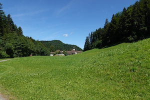
With a lovely summers day forecast, Jules and I headed over to Thurgau to try walk #18 from the favourite Rother book "Rund um den Zurichsee" not quite believing that we haven't done this one before. It starts at a brewery (sorry, Kloster)!
We parked in the shade of the trees outside the Kloster and set off up the hill. The first kilometer or so was a little bit busy with motorbikes out enjoying the lovely weather, but we were fairly quickly off the road and into the woods. The route climbs fairly steadily up to the old church (now restaurant) at Iddaburg. We decided decided not to stop for a drink and instead headed on our way.
The route follows the ridgeline before dropping down to Mühlrüti, with lovely views over the Churfusten and Säntis. We stopped for lunch under a cherry tree, where yours truly demonstrated that they're very bad at jumping for cherries! We continued on down the hill, and were very grateful for the water fountain at Bechten. From there the route follows the valley for a bit, before starting the last climb up to Hohgrat/Groot. This is the highest point in canton Thurgau at a nose-bleed 996m. From those dizzy heights it was a steady descent back down to the Kloster. The highlight of the descent was the strawberry farm where Jules indulged a little. The second highlight of the descent was the Brauerei at the Kloster which made yours truly very happy.
The overall 17.3km with 725m of ascent/descent took us 4 hrs 20 all in. We'd rate it a T1+, and the gpx plot of the route is here.
Walking Unter Reppischtal - July
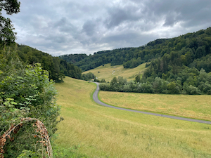
With a bit of a mixed day forecast (again!), but with a brighter spell predicted in the afternoon and keen to get out for a stretch of the legs, Jules and I headed down to Birmensdorf to try walk number 03 from Wanderungen in der Schweiz - Unter Reppischtal.
Arriving in Birmensdorf we realised that we'd done almost exactly this route before, but we set off undeterred! The route joins the Reppisch stream at Birmensdorf and then broadly follows this route through the military training area, climbing slightly at Honeret before dropping back down to re-join the stream at Reppischhof. From there it’s a gentle downhill all the way to Dietikon. We did a slight variation on the published route, and instead headed straight to Dietikon station rather than take the bus.
It was fairly quiet on the day - most people probably electing to stay indoors given the weather. We did see a young kite, plus some small perch in the pond at Bergfrieden. It was also interesting to see the field planted with Urdinkel (spelt) and advertised as such.
This is a gentle afternoon’s walk, a short distance from town, and should be good in most weathers. Overall the 9.2km with just 100m ascent and 200m descent took us 1 hr 55 without breaks. We rate it a T1 and the gpx plot of our route is here.
Walking Wollishofen to Horgen - June
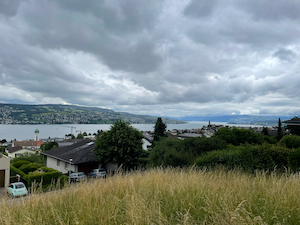
Fancying a gentle stretch of the legs without travelling too far, Jules and I headed down to Wollishofen to try a walk from Wanderungen in der Schweiz - Wollishofen to Horgen.
We started out from Wollishofen under grey skies and headed through the outskirts of the village. The walk was a bit urban at the start, but we did pass lots of lovely houses with very well manicured gardens. We eventually made it into woodland a bit before Thalwil and from there the walk follows a contour above the villages and below the motorway, with more mixed environs until we arrived at the outskirts of Horgen.
The weather was a bit overcast for most of the walk, threatening rain but never actually delivering. We tried out the Merlin bird-call app in the woods, which told us that we could hear Chaffinch, Common Chiffchaff, Blackbirds (of course) and also noted a Little Ringed Plover (although I'm not convinced about that myself).
We stopped for a pleasant coffee, a bowl of chips and some strawberries & cream for Jules in the remarkably friendly restaurant Frohe Aussicht a bit before Oberdorf. From there it was a gentle last stretch to finish in Horgen. Overall the 14.8km with 350m ascent/descent took us 3 hours 40 (including the stop and breaks) and we'd rate it a T1. The gpx plot of our route is here.
Walking Pfäffikon to Wila - May
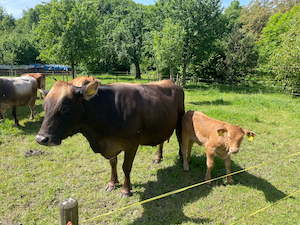
With a lovely day forecast and keen to get out and do a little training for our upcoming summer holiday, Jules and I headed over the Pfäffikon to follow the Jakob Stutz Weg to Wila.
It was an easy journey to Pfäffikon and found the well signed Jokob Stutz Weg quickly and easily. We were soon out of town and walking through the countryside in lovely weather. The route climbs gently for the first half of the walk passing through quite varied countryside. We crossed pretty little streams and past ponds, through mixed woods and small holdings. We were very happy to see some young calves playing in a field just next to some equally happy looking pigs and chickens.
The route peaks at about the half-way point, just above the village of Ravensbüel. From there it was a gentle descent on paths and tracks to Wila. The majority of the walk is in countryside - with really only the first and last 5 minutes in villages. Overall the 12.7km with 385m of ascent and 355m of descent took us 3 hours and 5 minutes, including a short rest stop. It's a T1 and the gpx plot of our route is here.
Walking Albispasshöhe Zug - May
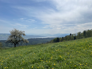
Deciding to forego the 1st May demonstrations and instead go for a nice walk in a lovely late spring day, Jules and I headed down to Albispasshöhe to do a walk that we've done before to Zug.
The weather was very kind to us and we set out under light hazy cloud cover but bright and cheerful. We were treated to great views over the Zürich See on the start of the walk, and then over the Alps once we'd crossed the Albis ridge. It was a Säntis to Pilatus day, and even further although some of the far Alps did disappear into the haze. To our slight surprise it wasn't such a great day for nature, although we did see a few kites and some crows, plus a lizard which was missing its tail
The route starts along the Albispasshöhe ridge in the shade of the woods before dropping down to loop around Baar and to finish in Zug. It's a lovely walk for a good stretch of the legs without travelling too far and perfectly do-able in a variety of weather conditions.
Overall the 18.2km with 325m of ascent and 650m descent took us 4 hrs 20, including a short picnic lunch and a break. We'd rate it a T1+ and the gpx plot of our route is here.
Walking Zofingen to Schöftland - April
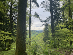
With a reasonably promising day forecast, and keen to get out for a short stretch of the legs, Jules and I headed over to Aarau to do a slightly shorter walk with Diana and Luis.
It was slightly colder than I expected when we arrived, and dressed only in shorts and a t-shirt yours truly was quite happy to get going! The walk starts in the pretty village centre of Zofingen and then climbs steadily uphill (good news for once - I wasn't cold at the top). We were treated to nice views of the Lucerne Alps through the tress, and then dropped out of the woods and down to Bottenwil. We stopped for a picnic lunch on some logs just past the village.
Suitably refreshed we climbed the last hill before dropping down into Schöftland to finish the walk. We stopped for one drink at the Zum Ochsen restaurant, but by then it was a bit chilly to sit outside and we got the distinct impressions that the restaurant would rather serve nice lunches to well dressed diners than beers to walkers!
Overall the 12.2km with 370m of ascent/descent took us 3 hours 25 including the picnic. We rate it a T1 and the plot of our route is here.
Walking Turgi to Baden - April
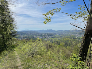
With a lovely day forecast, Luis and I headed to Turgi to do a short walk to Baden, heading over Hornebni.
It was a very pleasant spring day, and we were rewarded with lovely views from the top of the climb. We saw a huge amount of wild garlic growing over the hillside on the north facing slopes, and must remember to come back here in spring to collect some.
We stopped for a brief refreshment after the climb and then continued along the ridge before dropping down in to Baden via the ruined castle. We finished in Mr Pickwick's for a recuperatory drink, having completed the 8.0km with 250 ascent and 180m descent in 2 hours 10 minutes. It's a T1 and the gpx plot of our route is here.
Blossom Walk Thurgau - April
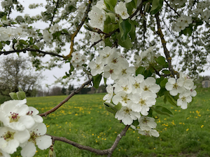
Hoping to catch the apple blossoms in Thurgau, Jules and I headed to Felben Wellhausen to repeat the walk to Bettwiesen "Thurgau im Bluescht"
We last did this walk in 2022, but were a bit late in the season on that occasion. This time the apple blossoms were in full bloom, and the cherry blossoms were just starting.
The walk starts with a good climb (which one of us remembered), and then into the rolling hills of Thurgau. We were a bit too early for the calves this time, but we did see some friendly-ish cows. The weather was very kind to us, with good views of the alps in the distance, the Bachtel and the Churfirsten. It was good to get out, and this is a lovely stretch of the legs in a warm spring afternoon.
Overall the 16.1km with 475m ascent and 325m descent took us 3 hours 50, including a picnic lunch. It's a T1 and he gpx plot of our route is here.
Oh, and we just about remembered to request the train to stop in Bettwiesen - worth paying attention to that!
Walking Uetikon am See - March
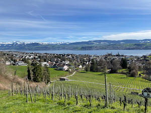
Taking the opportunity of a trip across to Uetikon am See, Jules and headed up the hill for a short walk, which we picked by plotting a route on the SwissTopo app.
It was a lovely spring afternoon by the time we'd finished looking at fabrics and odd bits of shopping, and we headed up the hill in glorious sunshine. It was a clear day, and we were treated to lovely views across the Zürichsee and the Alps from Speer to the Rigi on the way up.
We stopped for a short picnic lunch in the sun before the final climb, and the top of the hill found ourselves in familiar territory near Buechholz and the Vorderer Pfannenstiel. Not wanting to be out too late, we looped down near Oberchrüzlen, where we finally managed to see both Saentis and Pilatus (making it officially a day of great visibility) and even further west along the Alps. From there we continued back down and round to follow the Haslibach stream into Uetikon am See.
Overall it was 5.2km, with 280m of ascent and descent, which took us 1 hour 20 all in. We'd rate it a T1 and the gpx plot of our route is here.
Walking Türlersee - March
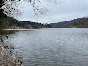
With a bit of a grey and dull day forecast, but keen to get out, Jules and I headed down to Aeugst am Albis and to try a variation on route #48 from Rother Rund um den Zurichsee.
We parked in the carpark behind the Türlersee, and headed off on the walk. We had to cut through to join the path at around Linden, but from there easy to follow. The route winds through the rolling hills of this part of Zürich, where spring was just starting to get underway. We saw kites, plus a buzzard, a heron, and a kestrel, a black squirrel (that looked well fed) , and the buds were just starting on a lot of the plants.
We stopped for a short picnic, but didn't hang around because it was a bit chilly in the March breeze. However, the next hill soon warmed us up! It's a nice stretch of the legs, a little bit out of town but without having to travel too far. Overall it was 9.8km, with 325m ascent and descent which took us and 2:40 including the picnic. We'd rate it a T1 and the gpx plot of our route is here.
Skiing Jakobshorn - March
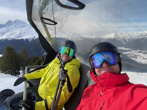
With a good day forecast and the snow in reasonable condition, Sevi and I headed down to Davos to ski Jakobshorn for the day
After a tiny bit of confusion about our destination (I hadn't realised that the ski area at Davos is so large, and with so many lifts) we arrived at the base of Jakobshorn. Being a Monday it was pretty quiet and we headed off up the hill with stress at all.
The conditions at the top were very pleasant - a bit below freezing and fairly bright and sunny. We spent the morning touring around the right hand side of the slopes - but having great fun doing fast carving on almost empty slopes and good visibility
Later on in the day we found some quite good off-piste areas, which I struggled with a bit at first - my technique not being that great this year for lack of practice, but improving later on in the day. All in all it was a lovely day out, expertly guided by Sevi and a lovely ski area. If only I'd known about it before!
Overall we managed 50.9km (!) and 11,000m of descent over 22 runs, which would explain why I was a bit tired at the end of the day!
Walking Uetliberg January
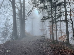
Fancying a stretch of the legs without too much travel, Jules & I headed down to the Uetliberg for a winter walk.
We started from Triemli and from there climbed the hill up towards the Uetliberg tower. It was a bit slow going, my lungs not fully recovered from a cold, but we made steady progress up through the cloud and fog. As we reached the top of the hill the visibility became much better and we sat in the sunshine just by the Uetliberg tower and ate our packed lunch. Suitably refreshed and recovered we carried on to Uto Kulm where Jules couldn't resist a crepe with Apfelmuss for dessert. We enjoyed the views over the cloud-covered Zurisee towards the mountains before heading down to Albisgütli to finish.
It was a really good choice of walks - a bit of exercise but without much travel. Overall the 6.5km with 440m ascent and 370m descent took us 2 hours 5 minutes (including the picnic and the crepe), and we'd rate it a T1+. The gpx plot of our route is here.
Skiing Hoch Ybrig - January
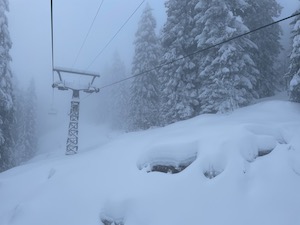
Wanting to get some practice in before skiing with Giley, I headed off to Hoch YBrig to squeeze in an afternoon by myself.
There had been lots of snow over the weekend, so I was optimistic about the conditions. Unfortunately I neglected to check the weather before heading off, and I arrived to find the cloud-base about half way up the mountain. On one hand, the snow was great, having had about 35cm down over the previous couple of days and then it having stayed cold. On the other had, the very low visibility meant that I was basically skiing pole to pole, and I even managed to head off the piste at one point, having missed the next one (or perhaps they were just a bit more widely spaced).
It wasn't the opportunity to discover the resort for which I'd hoped, but the area seemed good for one day, or longer in good snow conditions and knowing the area better.
I can't say that my technique was very good in those conditions, but it was nice to get out and practice balance and turns. I also noted the Stöckli test centre at Lauchern, perhaps worth remembering for when I get around to replacing my skis.
In total I managed 21.4km, and 3,000m of descent over 11 runs. My top speed of 40 km/h tells you everything you need to know about the visibility!
Skiing Flumserberg - January
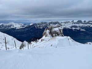
After a fairly relaxed new years eve, Jules and I headed down to Flumserberg to do a bit of skiing in the afternoon on new years day.
We weren't the only ones with this idea, and the car park was a little full, but after a brief drive around we managed to find somewhere to park, and we headed off to our respective pistes.
The conditions were alright for alpine skiing, better higher up and a bit hard packed in places, but it was good to get out and try to remember how it all works. I did a general cruise around the mountain, mostly on-piste but with a couple of detours. My technique was quite rusty at the start but seemed to loosen up a bit by the end. All in all it was a pretty successful afternoon for me, and Jules thoroughly enjoyed being out on the loipe too.
Overall I managed 24.1km, and 4,100m of descent over 14 runs. Fairly respectable for 2 hrs 30 and the first day of the season...