Cycling Storchen Tour - October
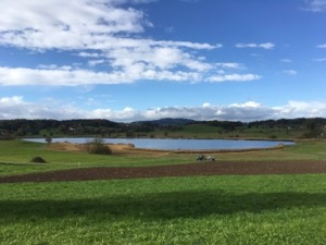
With a less-than-salubrious day forecast, but keen to get out and do a bit of exercise (partly for the benefit of Jules' leg) we headed over to Uster to try route #16 from the Veloland Zurich book, "Storchentour" (Stork tour).
We started out from Uster in the rain (but which cleared up pretty quickly), and did the route in reverse - mostly because we are familiar with the route to the Greifensee from the train station in Uster. From there the route meanders south-east through Mönchaltorf and Grüningen before reaching the Luetzelsee where it loops back to Uster. The route certainly didn't disappoint, mostly following very minor roads with almost no traffic. I was grateful that I'd plotted the route onto the Garmin though because it would have been a bit of a pain to navigate by paper.
Overall the 36.5km with 350m ascent/descent took us 2 hrs 15, which was a fairly gentle pace as about half way through Jules' leg started to complain going up hills and she elected to push, rather than risk an injury. The GPX plot of our route is here.
Faellanden - Pfaennensteil - August
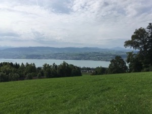
With a good day forecast and keen to get out for a bit of a ride without too much hassle, I headed off for a quick loop around Faellanden and the Pfaennensteil.
It made a pleasant change cycling from home without having to mess around with trains, and the route being fairly short (40km) meant that it also that not much preparation was required. All in all the route took me 1 hr 45, including the total of about 600m ascent/descent, going at a steady but not onerous pace.
I think this route could be a nice regular ride on a weekend morning, given the length and height gain and the fact it can be completed quickly and with little hassle.
Cycling Alpen Brevet Silver - July
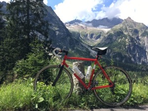
Deciding to take a next step up in terms of difficulty, I headed to the Andermatt region to have a crack at the Alpen Brevet Silver route, partly to see whether I could achieve it, and partly to see how much I would enjoy it.
The weather was forecast very well for the trip - mostly bright and sunny, but not too hot. I decided to do the route anti-clockwise (the same as the actual event), but to start/finish in Göschenen, owing to the slightly easier travel logistics from Zurich.
The route was pretty easy to navigate, just three lefts turns to get right over the course, and those pretty obvious and well signed. I started well and quite enjoyed the climb up to and over Susten pass - with a cracking descent into Meiringen. The climb up to an over Grimsel pass was a bit of a slog, with quite a lot of traffic, and the descent into Gletsch where you can see all the switchbacks of Furka pass is just rude!
Overall it was a good day, I did complete the route and finished in an acceptable state of tiredness. I reckon that the second/third passes are a bit more than I enjoy right at the moment - levels of fitness, etc., but I'm pleased I did it. Overall I was out for 8 hours 50 minutes, of which I was pedaling for 7 hours 10 minutes. I made the decision to stop regularly, and to focus on enjoying the day rather than aiming for a good time. The actual route that I did is here, and was 120km and 3,400m ascent/descent - very slightly less than the official route. That time for the route would have put me pretty much in the middle of the field for the actual event, which is an interesting point for me to note.
Glarus Klausenpass Brunnen - July
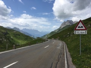
With a good day forecast, and keen to get a proper cycle ride in, Shep and I headed to the Glarus region to have a crack at the Klausen pass from the Glarus side.
We took the train to Ziegelbrugge, to avoid the long stretch down the side of the lake, and headed off a little after 9am. We were following the National cycle route #4, which heads all the way down the picturesque Glarus valley. We arrived at the base of the pass at about 10:30 and after a brief stop to refill water bottles we headed on up.
The actually ascent took about 1 hr 50 (which I was quite pleased with) and after a well-earned coffee at the summit we had a great blast on the descent (topping out at a little over 60 kmph, but don't tell Jules). From there it was a bit of a utility run along the side of Lake Lucerne to Brunnen for a well earned beer. That section of the lake is a bit of an unpleasant cycle-ride, but compensated by the lovely views.
Overall we were on the road for 5hrs 30, and pedalling for 4hrs 30 of that. It was a total of 90km, with 1,600m VG/L, of which 1,280 was the Klausen Pass itself. The GPX plot of the route is here.
Cycling Klosterfahr - May
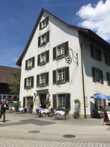
With a great day forecast, and keen to get out and stretch our legs, Jules and I headed out along the Sihl to Klosterfahr.
We had a couple of navigational challenges on the way, partly caused by trying to do it from year-old memories, and partly owing to closures on the cycle path. However we persevered, and arrived in time for a late lunch in the garden, finished off with the largest slice of apple pie Jules had ever seen. The weather was perfect for cycling - bright and sunny, but not too warm on a bicycle.
Overall the 18 or so miles took us about 1hr 30, at a pretty gentle pace through town, and on fairly good paths for most of the way.
Cycling Greifensee - April
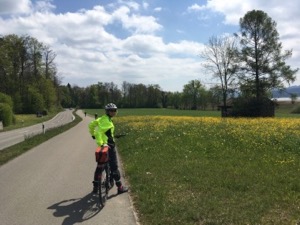
With a slightly -less-warm-than-expected day forecast, but bright and sunny and with us keen to get out, Jules and I headed out for a cycle ride to and a round the Greifensee.
We declined the route around the Zuriberg as being for wimps and instead headed over the hill and then round the far side of the Greifensee from Zurich. We stopped for a coffee at the cafe 8610 um Greifensee, pleased that it was actually open before continuing on round the lake. We decided to head back via Egg, crossing the hill near the Pfannensteil (stopping to see the new foal briefly). Unfortunately yours truly made a slight navigational error and we didn't take the (promised) long downhill descent back into town. Sense of humour slightly put out for some of the party on the home stretch.
All in all, it's a nice route, despite the couple of big-ish hills. In total it was a bit over 47km, and we were pedaling for a bit under 3 hours.
Cycling Round Zurisee - March
With a slightly grey, overcast day forecast, but keen to get out for a bit of a ride, Tom and I headed off for a quick lap of the ZuriSee.
It's not a bad ride overall - I clocked about 65km for the loop (crossing at Pfaeffikon/Rapperswil), and mostly flat with only 140m ascent/descent in total. The roads can be a bit busy with quite a few cars and cycling single-file was the order of the day.
We managed to keep up a fair pace - averaging slightly over 31km/h for the time we were moving (obviously not including the time in the cafe in Rapperswil) and completed the loop in slightly over 2 hours.
My new Condor performed very well - this was the first proper outing on it and everything seems to be working perfectly - I'm looking forward to using it on slightly more challenging rides...
Cycling Adliswil - March
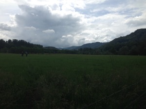
With a pretty grey and overcast day forecast, but keen to get out of the house, Jules and I headed off for a short cycle ride along the Sihl to Adliswil.
The rain managed to hold off for most of the ride, only starting to spit a little on the final leg, but that did have the advantage of persuading most of the pedestrians to go inside. The route is pleasant - flat and mostly off-road along the side of the river as it winds out of town. We went as far as the garden centre in Langnau and stopped for a coffee in the racquet centre in Adliswil.
Overall it was a pretty gentle ride, about 30km and at a relaxed pace. It was good to see that my oil change for the Rohloff speedhub seemed to have been successful, and the remaining end-of-winter maintenance for the Tout-Terrain meant that the bike was in pretty good shape to be packed away for the summer.